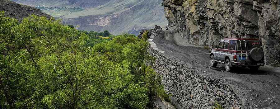
A Journey on Kalash Valley Road, Pakistan's Most Challenging Drive
Kalash Valley Road is a very defiant road located in the northernmost district of Pakistan, Chitral district, near the Afghanistan border. It’s one of the most challenging roads of the country.

How long is the Kalash Valley Road?
The bumpy road is totally unpaved and runs along the Kalash River. It is 17.6 km (10.93 miles) long, running east-west from Ayun on the N45 road, south of the town of Chitral, to Grum. The last section of the road is called Rumbur Valley Road.
Is the Kalash Valley Road challenging?
The road has dangerous narrow parts and severe drop-offs. Attempting it in anything but a high-clearance, preferably 4-wheel drive vehicle is a recipe for disaster. The road has no safety wall for the vehicles with lot of narrow turns, deep and danger terrains. Due to its condition, the trip can take up nine hours. Steams are also crossing in between the road due to cold and snowing weather and freezing temperature these water pools on the road turned into a solid and freezing snow that further made the task of the drives and pedestrian difficult.
Is the Kalash Valley Road open?
Set high in the Khyber Pakhtunkhwa province, the nerve-shattering road is pretty steep, with an elevation gain of 400m, ending up at 1.923m (6,309ft) above sea level. This route remains closed during the winters so it is highly non-recommended.
Road suggested by: Hugh Wilson
Pic: By Zindagi-zoq-e-Safar [CC BY-SA 4.0 (https://creativecommons.org/licenses/by-sa/4.0)], from Wikimedia Commons