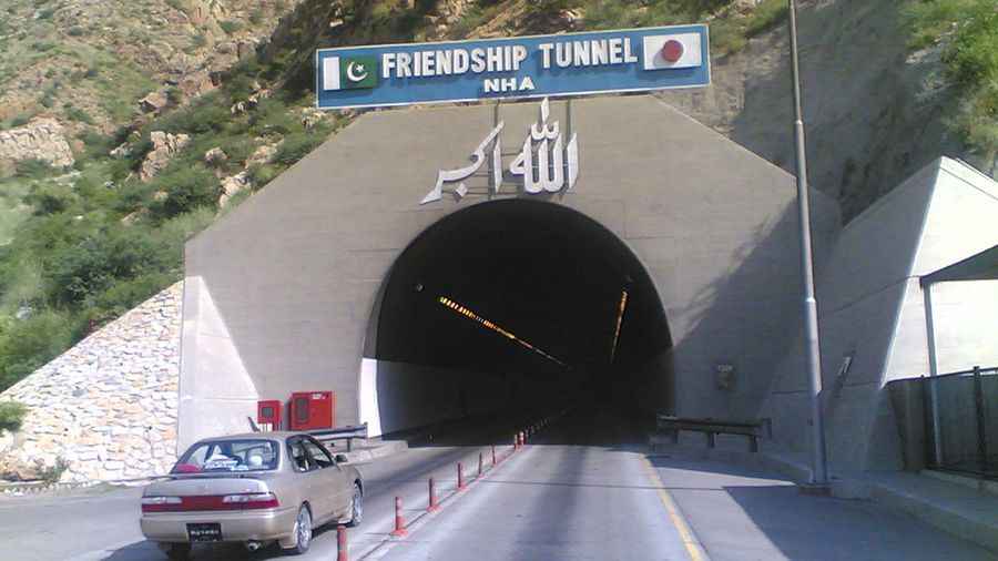
A hazardous road to Kohat Pass
Kotal Kohat is a mountain pass at an elevation of 855m (2,805ft) above sea level, located in Khyber Pakhtunkhwa, formerly known as the North West Frontier Province, in Pakistan.

How long is Kohat Pass?
Located in the northwestern region of the country, the road to the summit is fully paved and is known as Kohat Road. The pass is 20.4 km (12.67 miles) long, running from Babozi to Kohat.
How challenging is Kohat Pass?
The road over the pass is steep and very narrow for large vehicles. In 2003, the most challenging part of the pass was bypassed by the Kohat Tunnel, so traffic no longer has to navigate over rugged mountains, which were hazardous and time-consuming. Weather conditions can change quickly, particularly during winter. Snow, ice, fog, and rain can create dangerous driving conditions and disrupt travel. Landslides caused by heavy rain can block or wash away roads.
When was Kohat Pass built?
Set high in the Khigana Mountains, British authorities in Peshawar began construction of the Kohat Pass road in 1849 and completed it by 1850 despite violent opposition from local tribes. The pass was temporarily closed in 1853 after a quarrel arose among nearby tribes.
Is it safe to drive through Kohat Pass?
Exercise a high degree of caution in Pakistan due to the unpredictable security situation. There is a threat of terrorism, civil unrest, sectarian violence, and kidnapping. Attacks on security and military forces occur frequently, and civil unrest happens regularly. Remember to travel on mountain roads only during daylight hours and consult local authorities regarding road openings, particularly during the monsoon rains and winter seasons.
Pic: By Manzoor Ahmad, CC BY 3.0, https://commons.wikimedia.org/w/index.php?curid=56131488