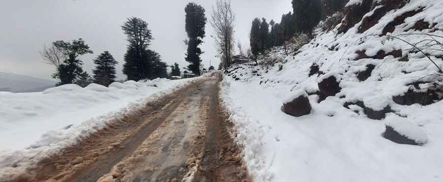
A scary road to Lasdana in the mountains of Pakistan
Lasdana is a touristic hilltop at an elevation of 2,596m (8,517 ft) above sea level, located in the north-eastern area of Tehsil Rawalakot in the Poonch District of Azad Kashmir, Pakistan.

Is the Road to Lasdana Paved?
The road to the summit, known as the Lasdana - Mahmood Gali Road, was paved a few years ago, but its condition has deteriorated and is now very poor. While the road is mostly accessible by passenger cars and RVs, it is narrow, with many curves and blind turns that require careful navigation. The road has some steep sections, with a maximum gradient of 17.7%. At the top of the pass, you'll find a bar and a resort for visitors.
How Long Is the Road to Lasdana?
The road spans 20.8 km (12.92 miles) and runs north-south, connecting Mahmood Gali to Nar Sher Ali Khan.
How Challenging Is Driving to Lasdana in Winter?
The road to Lasdana is stunningly scenic, making it one of the most attractive points in Rawalakot. However, driving can be dangerous, especially during rain or in the evening. Weather conditions can change rapidly in winter, with snow, ice, fog, and rain creating hazardous conditions. Landslides triggered by heavy rain may block or wash away sections of the road, adding to the challenges.
When Is the Best Time to Drive to Lasdana?
The winter season runs from November to March, while the rainy season occurs from April to June. Exercise caution when driving, particularly during these periods. Additionally, travelers should be aware of the security situation in the region, as there is a threat of terrorism, civil unrest, sectarian violence, and kidnapping. Always check local conditions before embarking on your journey.
Road suggested by: Jorge Manuel Gómez Sánchez
Pic: Idris Sheikh