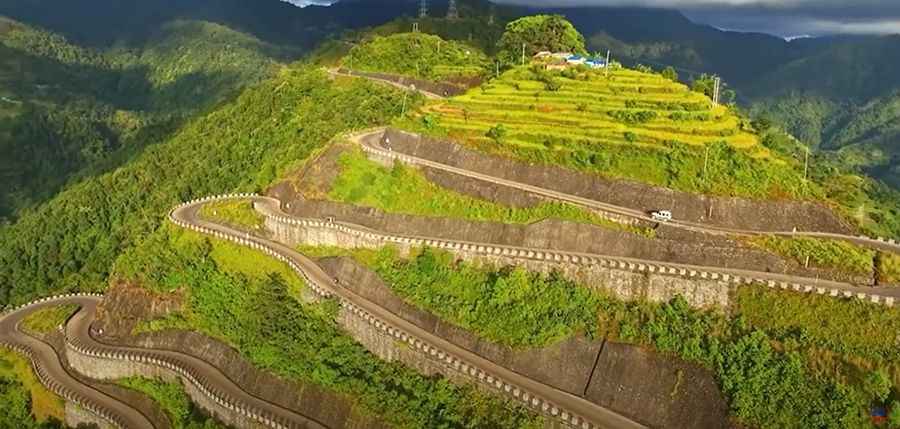
Driving the amazing BP Highway in Nepal
Located in the heart of eastern Nepal, BP Highway is a very scenic journey with stunning views. You have to be careful on your drive as the road, with sharp bends, is narrow.

Why is it called BP Highway?
It is named after the former leader of Nepal, Bishweshwar Prasad Koirala.
When was the BP Highway built?
Construction of the highway began in 1996 and it opened on 3 July 2015.
How long is the BP Highway?
The road, also known as H06 road and Banepa Bardibas Highway, is 158 km (98 mi) long, stretching from Dhulikhel (30 km east of Kathmandu) to Bardibas (where it meets the East West Highway). It’s totally paved.
Is the BP Highway worth it?
The road links the Kathmandu Valley with the Eastern Terai region passing through many rivers, hills, and valleys. This is a remarkable road trip. The highway offers an interesting and enticing drive with beautiful and picturesque bends. Various points on the road provide great vantage points to look at the majestic mountains and admire their beauty.
How long does it take to drive the BP Highway?
Allow 4 hours to complete the drive without stops. Make sure you leave enough time to make plenty of stops along the way.
Is the BP Highway dangerous?
The road is risky, locals warn. It is in good condition but narrow with too many curves and sharp hairpin turns. At few points, it hardly accommodates two crossing vehicles. Public vehicles with more than 18 seats have been prohibited for operation along the road. In the lack of speed control, accidents have become casual. Drivers don't consider the risk factors and are enticed by the sleek road to drive at high speed. The road is vulnerable to floods from local streams, earthquakes, and landslips. Several bridges along the 160 km long BP Highway have fallen into disrepair, damaged by floods, landslides, and soil erosion.
Road suggested by: Jorge Manuel Gómez Sánchez
Pic: Live Nepali News