What are the most spectacular roads in Kyrgyzstan?
Located in the heart of Central Asia, Kyrgyzstan is a dream come true for every driver, with stunning mountain roads. The country, one of the smaller Central Asian states, covers an area of 199,951 square kilometers and shares borders with 4 countries: Kazakhstan, Uzbekistan, Tajikistan and China.
With over 90% of its landmass lying above 1,500 meters in elevation, it’s easy to see why drivers will be able to discover high mountain roads like Torugart Pass, a challenging border crossing between Kyrgyzstan and China, at 3.752m (12,310ft) above sea level; or Tossor Pass, a thrilling (scary) off road experience, at 3,901m (12,798ft) above sea level, in the Issyk-Kul Region. The country offers many 4x4 experiences, such as the road to Kok-Airyk Pass, only passable on July and August, at an elevation of 3.850m (12,631ft) above sea level. Driving through the pass, the driver will negotiate about 15 snaking sections of uncovered road with some stony places. Kyrgyzstan experiences a continental climate, with cold winters and warm summers, with significant regional variations due to its mountainous topography. For those seeking the most defiant drives, don’t forget to check out our content about the highest roads in Kyrgyzstan.
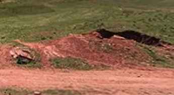
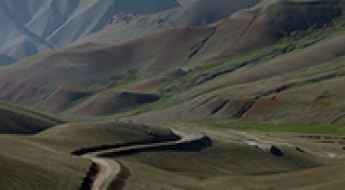
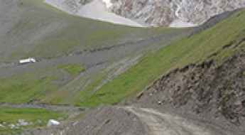
Avoid the road through Kyrk-Kyz Pass
Kyrk-Kyz pass is a high mountain pass at an elevation of 3.222m (10,570ft) above the sea level, located in Naryn Province, in the east of Kyrgyzstan.
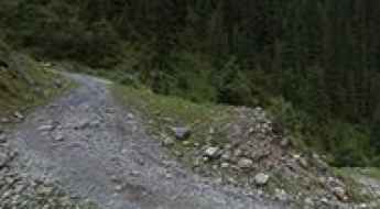
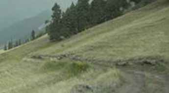
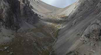
Road trip guide: Conquering Karakol Gorge
Karakol Gorge is the name of an alpine canyon carved by Karakol River, located in Ak-Suu District, in the Issyk-Kul Region of Kyrgyzstan.
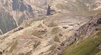
Pereval Kitjine-Sarybeles
Pereval Kitjine-Sarybeles is a high mountain pass at an elevation of 3.542m (11,620ft) above the sea level, located in the At-Bashi District of Naryn Province of southeastern Kyrgyzstan.
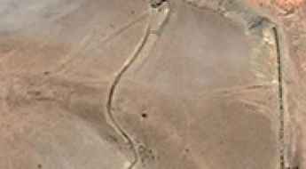
Here's How To Have The Ultimate Road Trip To Pereval Taunmurun
Pereval Taunmurun is a high mountain pass at an elevation of 3.545m (11,630ft) above the sea level, located in the Osh Region of Kyrgyzstan.
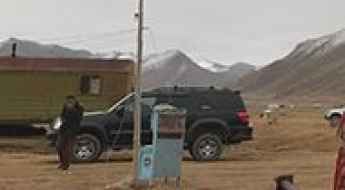
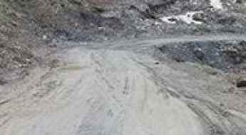
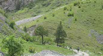
The road to Base Camp Maida Adyr is for drivers with strong nerves
Base Camp Maida Adyr is a high mountain camp at an elevation of 2.600m (8,530ft) above the sea level, located in Ak-Suu District, southeast Issyk-Kul Region, Kyrgyzstan.
Pereval Choloktor
Pereval Choloktor is a high mountain peak at an elevation of 3.618m (11,870ft) above the sea level, located in Jalal-Abad Region of Kyrgyzstan.
Travel guide to the top of Pereval Masail
Pereval Masail (Masail Pass) is a high mountain pass at an elevation of 3.275m (10,744ft) above the sea level, located in the remote Naryn Region, in the east of Kyrgyzstan.
Pereval Akkyl
Pereval Akkyl is a high mountain pass at an elevation of 2.926m (9,599ft) above the sea level, located in the Jalal-Abad Region in western Kyrgyzstan.
Driving the historic Pamir Highway to Pereval Soroka
Nestled in the heart of Kyrgyzstan, Pereval Soroka soars to heights of 3,560m (11,679ft) above the sea, offering an intriguing traverse through the Osh Region.
Pereval Tuzduu-Suu
Pereval Tuzduu-Suu is a high mountain pass at an elevation of 1.970m (6,463ft) above the sea level, located in Jalal-Abad Region of Kyrgyzstan.
Pereval Dzhargart
Pereval Dzhargart is a high mountain pass at an elevation of 3.540m (11,614ft) above the sea level, located in Jalal-Abad Region of Kyrgyzstan.
A memorable road trip to Pereval Ak-Bel'
Pereval Ak-Bel' is a high mountain pass at an elevation of 3.594m (11,791ft) above the sea level, located in the remote Issyk-Kul Region in north-eastern Kyrgyzstan, near the Chinese border.
Conquering Peak Patamushta in Kyrgyzstan
Peak Patamushta is a high mountain peak at an elevation of 4,088m (13,412ft) above sea level, located in the At-Bashy district of the Naryn region in Kyrgyzstan.
Dzhuku Pass: Only for Experienced Drivers with Advanced Off-Road Skills
Pereval Dzhuku is a high mountain pass, situated at an elevation of 3,736m (12,257ft) above sea level in the Issyk-Kul District of Kyrgyzstan.
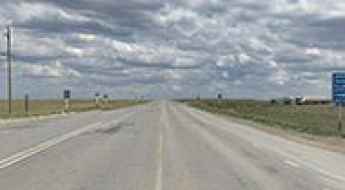
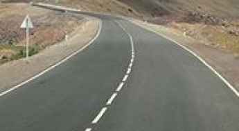
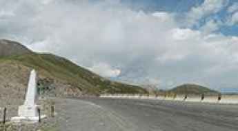
Embark on an Epic Journey: Discover Kazakhstan's M32, the Modern Silk Road
M32 is one of the main highways in Kazakhstan. It crosses the country, running from the Russian border towards the border with Kyrgyzstan. It’s a good road for those who wish to undertake such a journey to the heart of the country.
Driving the wild road to Kichik-Alay Pass
Pereval Kichik-Alay is a high mountain pass at an elevation of 4,140m (13,582ft) above sea level, located in the Osh Region of Kyrgyzstan. It’s one of the highest roads in the country.
How to drive the unpaved road to Shiman-Bel’ Pass?
Pereval Shiman-Bel’ is a high mountain pass at an elevation of 3,522m (11,555ft) above sea level, located in the Chong-Alay District of Kyrgyzstan.
A Once in a Lifetime Drive through Koi-Jol Pass
Pereval Koi-Jol is a high mountain pass at an elevation of 3,823 meters (12,542 feet) above sea level, located in the Batken Region of Kyrgyzstan.
Driving the wild 4x4 road to the top of Pereval Kyzyl-Kasa
Pereval Kyzyl-Kasa is a high mountain pass at an elevation of 3,443m (11,295ft) above sea level, located in the Nookat district of Kyrgyzstan.
A memorable road trip to Pereval Kum-Bel in southwestern Kyrgyzstan
Pereval Kum-Bel is a high mountain pass at an elevation of 2,681m (8,795ft) above sea level, located in the Leylek District of Kyrgyzstan.
Driving the Unpaved 4x4 Road to Kosh-Moynok Pass in Osh Region
Pereval Kosh-Moynok is a high mountain pass at an elevation of 3,273m (10,738ft) above sea level, located in the Alay District of Kyrgyzstan.
A 4x4 Challenging Road to Kosh-Bel Pass in Osh Region
Pereval Kosh-Bel is a high mountain pass at an elevation of 3,577m (11,735ft) above sea level, located in the Kara-Suu District of Kyrgyzstan.
How to Drive the Unpaved Road to Askaly-Bell Pass in the Osh Region
Pereval Askala-Bel’ is a high mountain pass at an elevation of 2,824m (9,265ft) above sea level, located in the Alay District of Kyrgyzstan.
The Wild Unpaved Road to Ikizyak Pass in the Osh Region
Pereval Ikizyak is a high mountain pass at an elevation of 3,520m (11,548ft) above sea level, located in the Alay District of Kyrgyzstan.