Travel guide to the top of Mount Korek in the Kurdistan
Mount Korek is a high mountain peak at an elevation of 2.103m (6,899ft) above the sea level, located in the province of Erbil, in the Kurdistan Region of Iraq.
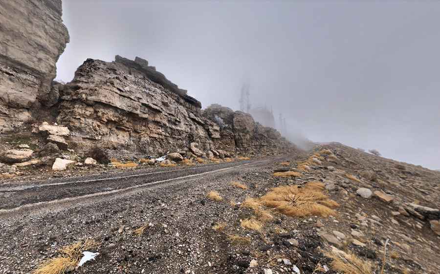
Is the road to Mount Korek paved?
Tucked away on the northern part of the country, close to the borders with Iran and Turkey, the road to the summit, also known as Mount Korak, is called Korek Mountain Road. The road is mostly paved but you’ll need a 4x4 vehicle to reach the summit because the last kilometers are unpaved, steep, with dangerous drop offs and without any protection.
How long is the road to Mount Korek?
Set high in the Zagros Mountains, the road to the summit is 20km (12.42 miles) long, starting at Khalifan. The drive is pretty challenging with 30 hairpin turns and steep parts. The elevation gain is 1.422 meters and the average gradient is 7.11%. The road is usually impassable in winters, with between 60 – 100 days of snowfall from December through March.
How to get to Erbil Observatory?
The summit hosts the Erbil Observatory, a ruined Iraqi National Observatory Dome with three telescopes. Established in 1973, the Iranian rockets launched during the Iran–Iraq War destroyed the partly-built observatories. The summit offers stunning views of Bikhal Waterfall.
Pic: Ziyad muhamad