The Volcanic Road to Mount Sabalan: Navigating Iran's Majestic Stratovolcano
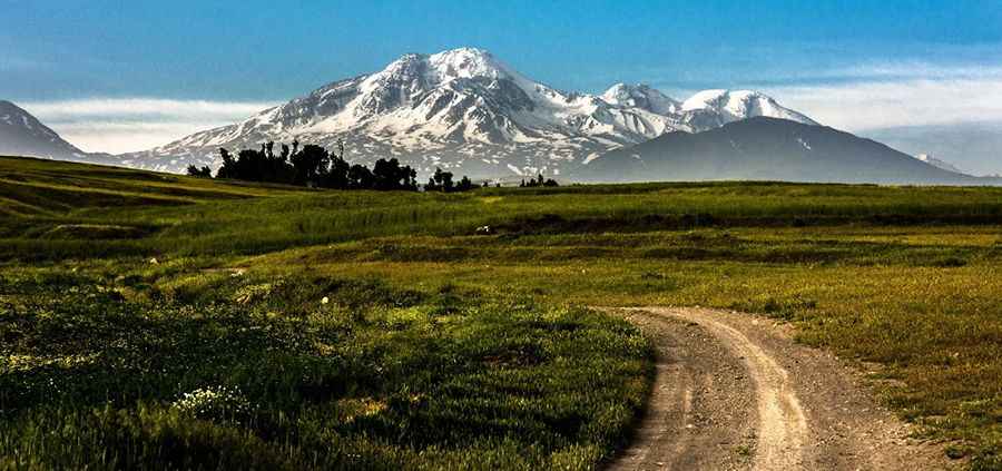
Mount Sabalan, situated in Meshgin Shahr County, Ardabil province of Iran, stands as a semi-active stratovolcano. A rugged gravel road leading north of its summit reaches an impressive altitude of 3,675m (12,057ft) above the sea level. It's one of the highest roads of the country.
Can I drive to Sabalan Second Eastern Shelter on the way to Sabalan volcano?
Located within the towering Alborz mountain range, the unpaved road culminates at the Sabalan Second Eastern Shelter. Its terrains, fashioned from ancient volcanic pumice, are notably steep and uneven, necessitating 4x4 vehicles for safe navigation.
How long is the road to Sabalan volcano?
The road to the shelter is 33.0 km (20.50 miles) long starting at Lahrud, a city in Meshgin-e Sharqi District. Along this journey, travelers will encounter numerous nomadic encampments, home to local shepherds.
Is the road to Sabalan Mountain open?
Positioned in Iran's northwestern region, Mount Sabalan proudly ranks as the nation's third-highest peak. However, accessibility is a challenge. The gravel path is frequently obstructed by substantial winter snowfall, rendering vehicular access impossible. With annual precipitation ranging between 400 and 700 mm, the road remains snow-clad for the majority of the year. Additionally, the mountain boasts permanent natural glaciers, further testament to its icy disposition.
Pic: Koorosh Nozad Tehrani