Driving a military road to the summit of Cheekha Dar in Kurdistan
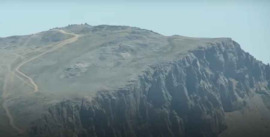
Cheekha Dar is a high mountain peak at an elevation of 3,592m (11,784ft) above sea level, located on the border of Iran and Iraq. A military road to the summit has been recently built.
Where is Cheekha Dar?
The peak, which means "Black Tent," links the Choman District in northern Erbil Province of Iraq and the Piranshahr County in West Azerbaijan Province of Iran. At this elevation, it’s the highest peak in Iraq.
Who built the road to Cheekha Dar?
The road to the summit was built recently by the Iranian army to construct a military base at the summit and fence it with barbed wire. It’s totally unpaved.
How dangerous is driving to Cheekha Dar?
Set high in the Sakran Range of the Zagros Mountains of Kurdistan, the area is not safe for traveling, so it’s better to avoid it at all costs. There is a danger of land mines in the area on the approach. This is an area that sees no visitors, so be aware because you are moving in a very sensitive area very close to the border between both countries. Iraqi officials say that Iran has built dozens of military outposts in the border areas of Pishdar, Choman and Sidakan.
Road suggested by: Hugh Wilson
Pic&video:Rudaw English