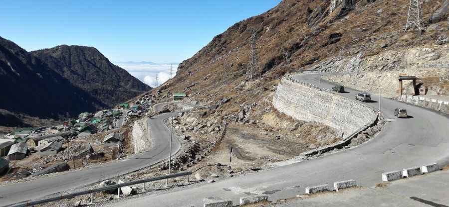
Navigating the road to Tsomgo Lake, Sikkim's high-altitude treasure
Tsomgo Lake is a high mountain lake at an elevation of 3,753m (12,313ft) above sea level, located in East Sikkim, in India.

How long is the road to Tsomgo Lake?
The road to the glacial lake is called Road 310. It is also known as Jawaharlal Nehru Road or the Gangtok-Nathula Highway. Starting from Gangtok, the capital of Sikkim, the ascent is about 40km (25 miles) long. The road has been improved as of 2017, but it can still be challenging due to weather conditions.
How challenging is the road to Tsomgo Lake?
The road to Tsomgo Lake, also known as Tsongmo Lake or Changu Lake, is very scenic, with mountain views and waterfalls. Due to sharp curves and steep parts, remember to eat lightly to avoid altitude sickness.
Why is Tsomgo Lake famous?
This glacial lake, meaning "source of water" in the Bhutia language, is revered by the Sikkimese. It reflects different colors with the changing seasons and remains frozen in winter.
Can I drive to Tsomgo Lake?
Tsomgo Lake is in a restricted area of Sikkim. Indian tourists need permits to visit. Foreign tourists need special permits, must travel in groups of two or more, and should apply through a registered travel agency. The road to Nathu La runs along the lake's northern side.
Pic: debasish borgohain