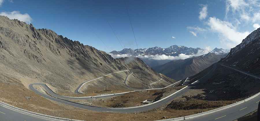
Driving the Legendary Road to Balang Shan Pass
Balang Shan La is a high mountain pass at an elevation of 4,485m (14,714ft) above sea level, located in the Sichuan Province of China.

Where is Balang Shan Pass?
The pass is located at the boundary of three counties: Xiaojin County, Wenchuan, and Baoxing of Ya'an, at the edge of the Tibetan Plateau. To the east lies the Wolong Giant Panda Nature Reserve, and to the west is the Siguniang Mountain Scenic Area.
Why is it called Balang Shan Pass?
The top of the pass, also known as Banlan, offers breathtaking views of the mountainous region to the west and the snowcapped Siguniang Mountains. In the Tibetan language, it is called Balangla, meaning "the mountain of strange willows."
How long is Balang Shan Pass?
The road to the summit is fully paved and is known as the Former 303 Provincial Road. The pass is 26.8 km (16.65 miles) long and features 30 hairpin turns. It’s a truly challenging drive—very steep and surrounded by snowy mountains.
Is Balang Shan Pass still in use?
The road is often severely damaged by rain, snowfalls, and landslides and can be closed at any time. Due to its geography and altitude, the most challenging part of the road has been bypassed by the Ba Lang Shan Tunnel, which is 8.8 kilometers long. Thanks to this tunnel, drivers save a significant amount of time.
Is Balang Shan Pass worth the drive?
Located between the Siguniang Mountains and Wolong National Park, the pass is blessed with a diversity of landscapes, including alpine meadows, river valleys, and alpine flowstone slopes.
Road suggested by: Hugh Wilson
Pic: Ivan Provorov