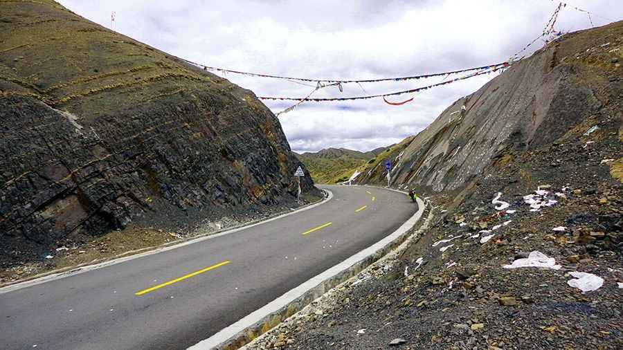
Take An Unforgettable Drive to Pang La
Pang La is a high mountain pass at an elevation of 4.736m (15,538ft) above the sea level, located in the Tibet Autonomous Region of China.

The road to the summit is paved. It's called Provincial Road 349 (G349). On this road you're firmly on altitudes over 5,000m. For an unacclimatized person this can be fatal. The breathtaking scenery ranks as some of the most inhospitable terrain on the planet. Expect many stretches with no water or food for tens or hundreds of kilometres, dozens of high passes, no shower or even a wash for weeks, and nightime temperatures of -25 degrees C or lower. The road is long and arduous and crosses several mountain passes of 5,000, 4,000 and 3,000 meters. This road passes through remote areas, so you need to be prepared. Despite its reputation for running through terrain that is by and large uninhabited, the road does pass through a number of important historical and religious sites. If you do choose this route please check up to date information. It's a windy place and it's one of those places where you can feel hard winds coming from two directions at the same time.
Check the weather forecast before you begin your trip. The extremely high altitude of Tibet makes the winter seasons extremely harsh, marked by extreme cold with gust of strong winds, blowing almost all the time. Therefore it is better to avoid any trip to Tibet during winter. Half of the roads remain closed due to heavy snowfall. The atmosphere becomes extremely arid and almost intolerable. Even in summer you can confront with snowy days. Temperatures here in the winter are brutally cold. There are truck stops along the way, about a day’s travel apart, but it’s wise to bring food and a sleeping bag. A tent can be useful in emergencies. Monsoon always begins from July and end up with August. It rains a lot during Monsoon time and it makes self-driving travel difficult to handle with. And remember, in China, a lot of websites are censored so you won’t be able to access any url you want (especially if Tibet is mentioned). The pass is 61.5km (38.21 miles) long, running west-east from Sangsang to Kagazhen.
Road suggested by: Hugh Wilson
Pic: 程亮