The breathtaking road to Yotong La
Yotong La is a high mountain pass at an elevation of 3,436m (11,272ft) above sea level, located in Bhutan. It’s one of the highest roads in the country.
Where is Yotong La?
The pass, also known as Yatong La, is located on the boundary between Bumthang and Trongsa Districts, in the central part of the country.
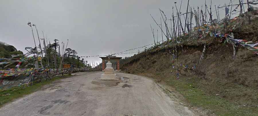
What’s at the summit of Yotong La?
Prayer flags hang at the top of the pass. On the west side, you pass through a hardwood forest, while on the east side, it transitions into a pine tree forest with small villages and beautiful houses. A gravel side road south of the pass climbs up to 3,521m (11,551ft) above sea level, leading to a radio/TV repeater station. This road is very steep and narrow, requiring 4x4 vehicles with high clearance.
Is the road to Yotong La paved?
The road to the summit is fully paved but in very bad condition, with some gravel sections. It is also steep, featuring hundreds of turns and narrow parts. It’s called the Bumthang-Ura Highway.
How long is the road through Yotong La?
Built in the 1990s, the road through the pass is 65km (40 miles) long, running west-east from Trongsa (the capital of Trongsa District) to Jakar (the district capital of Bumthang District) in the central-eastern region of Bhutan.
Is Yotong La open?
Set high in the Black Mountains, the pass is often closed during winter for a day or two due to heavy snowfall. It is quite unusual that from early April to May, there is no snow at this height. The top of the pass is frequently covered in mist.