Road Trip Guide: Conquering the Devil’s Bridge of Armenia
Devil’s Bridge (Satani Kamurj) is a natural bridge over the Vorotan River, located near Tatev village in the Syunik Province of Armenia. It’s one of the most gorgeous and marvelous natural spots in the country.

Why is Devil’s Bridge of Armenia Famous?
The bridge—one of Armenia’s natural wonders—is located in the canyon of the Vorotan River. It is situated in the deepest part of the gorge, at a depth of 700-800 meters. The section of the canyon where the bridge is located is so narrow that even sunlight can’t reach it. Over millennia, wind and water have created this natural wonder, polishing and piercing the petrified lava. The width of this natural bridge is 60 meters, and its length is 30 meters.
Why is it Called Devil’s Bridge?
Some people say the bridge is called so because many people have drowned while swimming under it.
Is the Road to Devil’s Bridge Paved?
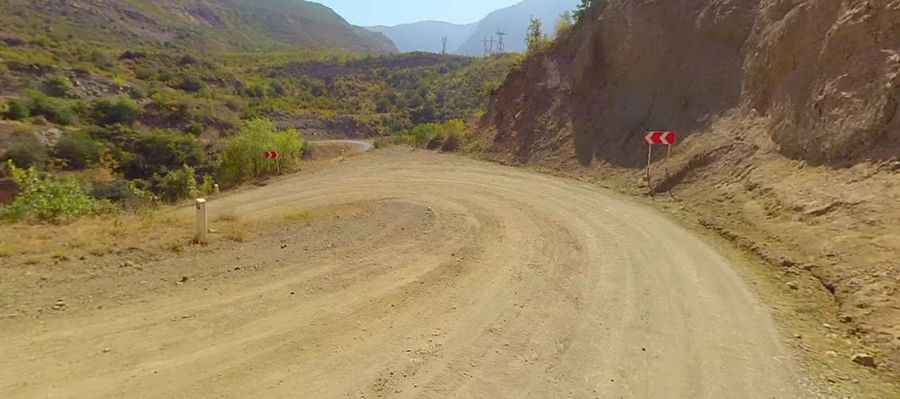
The road to this amazing tourist spot is paved on the eastern side and gravel on the western side. It is quite narrow and steep. It’s called H45.
How Long is the Road to Devil’s Bridge?
Located below the Tatev Monastery, the natural bridge is situated between the villages of Tatev and Halidzor. The road is 13.4 km (8.32 miles) long. The drive is very scenic but steep, with 24 hairpin turns. The road darts out onto the edge of a gigantic cliff, under which, about 500 meters below, is the roaring Vorotan River. With its twisting, serpentine turns, the road descends to the famous bridge. The weather here is unpredictable; driving along a dry autumn road doesn’t guarantee that, in just 300 meters, you won’t encounter winter conditions with snow-covered mountains and hills, and snow glistening like diamonds.