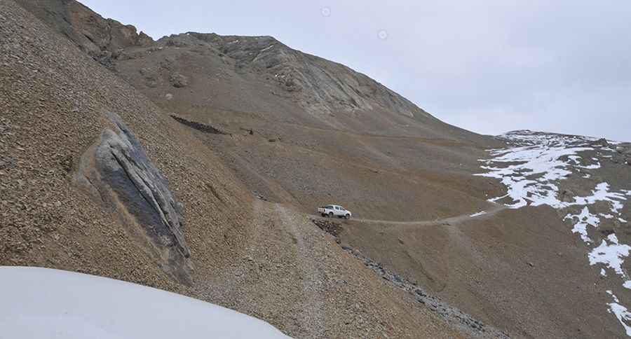
Driving the Road to Anjuman Pass is Not a Piece of Cake
Kotal-e Anjoman is a high mountain pass at an elevation of 4,430m (14,534ft) above sea level, located in Badakhshan Province, in Afghanistan. The road to the summit—or lack thereof—is extreme.

Where is Anjuman Pass?
The pass is located in the northeastern part of the country and connects the Panjshir Valley to the south with Badakhshan to the north.
How long is Anjuman Pass?
The pass is 32.4 km (20.13 miles) long, running south–north from Saricha Road, near Anjuman, to Korogah.
How challenging is Anjuman Pass?
Set high in the Hindu Kush range, within the Anjuman Valley, the road through the summit is extreme, with narrow parts and steep drop-offs. It’s completely unpaved and shouldn’t be attempted by novice drivers. Only 4x4 vehicles are suitable.
Some accounts have stated that the road was hastily constructed during the Taliban regime to bring food and supplies into the province from Badakhshan. However, according to a former aid worker who crossed the pass in 1999, this is not accurate. He recalls:
"The road—if you could call it that—was a rough track from Faizabad to Panjshir when we traveled it. The Taliban had never reached that far north at the time. The route had existed long before them, as an ancient connection between the Wakhan Corridor and southern valleys like Kokcha and Panjshir, leading all the way to Kabul."
He also noted that during the winter of 1999–2000, the Northern Alliance maintained a small camp just below the summit to keep the road open. Snow could reach depths of up to four meters, and in some cases, the team carved tunnels through the drifts to keep the pass navigable. In one case, a driver went missing during a severe snowstorm:
"We feared the worst and sent search parties, but they couldn’t reach the summit. Miraculously, the driver reappeared three weeks later, having stumbled upon the maintenance camp. They saved his life."
Can I drive through Anjuman Pass?
Avoid all travel to Afghanistan due to the security situation, including terrorist attacks, ongoing armed conflict, the risk of kidnapping, arbitrary arrest and detention, and the high crime rate. If you do choose this route, please check up-to-date information due to the security situation. It's crucial to thoroughly research current conditions. You might want to contact your embassy in Kabul for the most reliable information.
The remoteness of this area is often exploited by insurgents or drug traffickers who use these high mountain passes to connect zones near Pakistan with areas on the border with Tajikistan.
Road suggested by: Hugh Wilson
More info&pics:: https://hassellhess.wordpress.com/2010/10/18/over-the-river-and-through-the-mountain-pass/