Road trip guide: Conquering the Unai Pass
Unai Pass is a high mountain pass at an elevation of 3,000m (9,843ft) above sea level, located in Maidan Wardak Province of Afghanistan.
Unai Pass is a high mountain pass at an elevation of 3,000m (9,843ft) above sea level, located in Maidan Wardak Province of Afghanistan.
Where is Unai Pass?
The pass is located in the eastern part of the country, high in the Sanglakh Range.
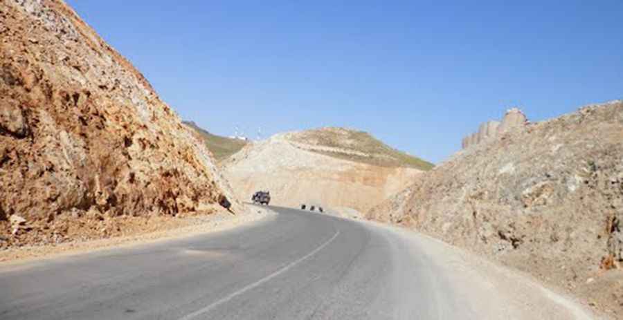
Is the road through Unai Pass paved?
The road to the summit is totally paved. It’s called Behsud-Kabul Highway and is the main road connection of Kabul with Hazarajat. But don’t be fooled by the highway name, as the road conditions are very dangerous, with zones without central lines, curvy sections, and steep parts.
How long is Unai Pass?
The pass is 66km (41 miles) long, running east-west from Sahqadam to Zarkharid.
Is it safe to drive the road to Unai Pass?
Remember, traveling by road in Afghanistan is extremely dangerous. The security situation is highly volatile, with terrorist groups and criminals often setting up fake checkpoints to rob or kidnap travelers. Roads are in very poor condition, and fatal accidents are common due to reckless driving, lack of enforcement, and unsafe vehicles. There’s also a serious risk from landmines and unexploded ordnance, especially in rural or remote areas. Women face restrictions on movement and can’t travel alone, often being harassed at checkpoints. Even in cities like Kabul, overland travel is not safe, and border crossings can close suddenly or become targets of violence. For all these reasons, overland travel in Afghanistan should be strictly avoided. Most embassies have temporarily closed public services and suspended their activities in the country until security conditions allow for reopening, having temporarily relocated to other countries.
Pic: https://mw2.google.com/mw-panoramio/photos/medium/78178150.jpg