Driving the Wild Paved Road to Shibar Pass in the Koh-e-Baba Mountains
Kōtal-e Shibar is a high mountain pass at an elevation of 3,000 m (9,843 ft) above sea level, located in the Koh-e-Baba mountains of central Afghanistan.
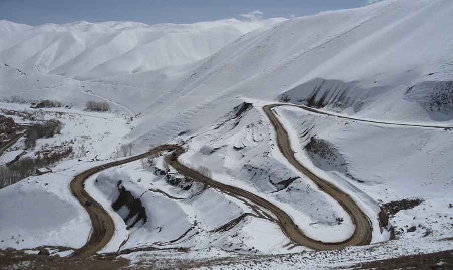
Is Shibar Pass Paved?
The road to the summit is mostly paved. It’s called the Bamiyan Charikar Highway (A77) and can be closed at any time due to snow. Drive with care, as this is a mountain road with sharp hairpin curves and dangerous drop-offs.
How Long is Shibar Pass?
The pass is 139 km (86.3 miles) long, running west to east from Bamyan (in Bamyan province) to Gulbahar (in Parwan province).
Can I Travel to Shibar Pass?
Travel to Afghanistan is strongly discouraged due to the current security situation, which includes the threat of terrorist attacks, ongoing armed conflicts, risks of kidnapping, arbitrary arrests and detentions, and a high crime rate. The security environment is unstable and poses significant dangers. If you are currently in Afghanistan, seek shelter in a secure location and proceed with caution if you need to relocate for safety. Remember that you are solely responsible for your safety, as consular assistance and support in the country are very limited.
Pic: naseerzeman