Driving the Military Road to Warghle Pass
Warghle Pass is an international high mountain pass at an elevation of 2,222m (7,290ft) above sea level, located on the border between Afghanistan and Pakistan.
Where is Warghle Pass?
The pass connects northeastern Kunar Province in Afghanistan with Khyber Pakhtunkhwa Province in Pakistan.
How Long is Warghle Pass?
The road to the summit is 66 km (41 miles) long, starting from Bajaur in Pakistan. On the Afghanistan side, there is no road infrastructure.
How Challenging is Warghle Pass?
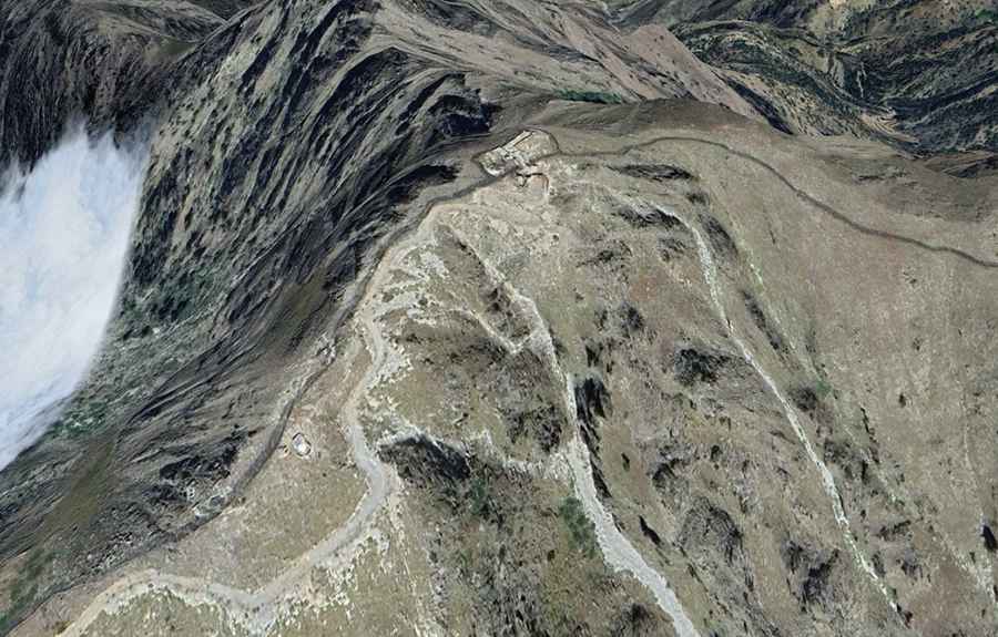
The road to the summit is highly challenging. It is a military road, mostly unpaved, with numerous hairpin turns, narrow sections, steep inclines, and dangerous drop-offs. The route is dotted with military structures along the way. It's a difficult drive, requiring high-clearance vehicles. Additionally, the road is closed to foreigners.
Is it Safe to Drive Through Warghle Pass?
Traveling in the border areas between Pakistan and Afghanistan is extremely dangerous due to significant security concerns. The presence of militant groups, ongoing military operations, and frequent violence make the region unstable. Kidnappings and terrorism are serious threats, particularly in remote areas. Many regions are restricted, and even with permits, most governments strongly advise against travel. Due to the high level of risk, it's best to avoid these areas altogether.