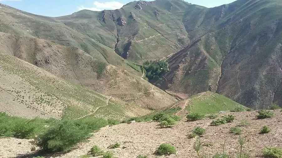
Navigating the hazardous road to Kotal-e Gardish Pass
Kotal-e Gardish is a high mountain pass at an elevation of 3.058m (10,032ft) above the sea level, located in Ashtarlay District of Daykundi Province in Afghanistan.

Is the road to Kotal-e Gardish unpaved?
Yes, the road leading to the summit is entirely unpaved, characterized by its countless sharp turns, steep inclines, and narrow stretches. Navigating this path requires utmost caution; ideally, travelers should use a high-clearance 4-wheel drive vehicle. For those with a fear of heights, certain sections may be particularly daunting. Driving in Afghanistan introduces challenges not just from the natural terrain but also due to the country's socio-political landscape. The ongoing conflict and political unrest amplify the risks, creating concerns about security. Travelers face potential threats from insurgent groups, unexploded ordnance, and frequent checkpoints. Moreover, navigating the local driving customs and habits, which might differ considerably from foreign conventions, further complicates the journey.
How long is Kotal-e Gardish?
Stretching 42.5 km (26.40 miles) from Barghosang to Korala, the route is best tackled during daylight. Night-time expeditions are strongly discouraged. The winter months, with their propensity for snowfall, make the already challenging path even more treacherous.
Road suggested by: Hugh Wilson
Pic: Aomed Yaghoobi