The Most Dangerous Roads in the USA
Driving is an essential part of American life, but it comes with substantial risks. In 2020, the United States saw its highest traffic fatality rate since 2007, at 1.37 fatalities per 100 million vehicle miles traveled. Certain roads are far deadlier than others due to factors like heavy traffic, treacherous weather, poor road design, or unique hazards. From crowded interstates to isolated mountain passes, this article examines the most dangerous roads across all regions of the U.S. Here, Dangerous Roads staff delve into accident statistics, road conditions, design flaws, traffic volumes, and historical incidents that make these highways especially hazardous.
Below, we cover notorious roads region by region, including comparative rankings and data from government agencies and research organizations. Buckle up for an informative ride on America’s most dangerous highways.
U.S. Route 1 (Florida) – The Deadliest Road in America
Stretching from Key West, Florida, up the East Coast, U.S. Route 1 is often cited as the single deadliest road in America. The Florida segment of US-1 sees an average of 108 deaths per year, the highest of any U.S. road. This staggering toll is attributed to a combination of high traffic volume (it connects major cities and tourist areas in Florida), frequent distractions, and driver behavior. Florida has only a partial ban on cellphone use while driving, and many crashes on US-1 involve texting or other distracted driving. Additionally, the road passes through densely populated areas and popular beach towns, mixing local traffic with tourists unfamiliar with the roads. Speeding is another significant factor on Florida’s US-1, as are occasional drunk-driving incidents given the nightlife in cities like Miami and Fort Lauderdale.
Road Design and Conditions: Parts of US-1 in Florida (such as the Overseas Highway through the Keys) are narrow, with limited passing opportunities and minimal shoulders. In urban stretches, frequent intersections and stoplights increase the risk of collisions. Congestion is common, and impatient drivers sometimes take reckless chances. The combination of heavy use and insufficient safety features (like a lack of median barriers in some stretches) leads to many head-on and side-impact crashes. Weather can add to the danger – sudden heavy rain in Florida can make US-1 slick and flood-prone, contributing to multi-vehicle accidents.
Notable Incidents: Law enforcement agencies have stepped up patrols on US-1 given its grim statistics. Despite efforts, tragedies continue to occur regularly, cementing US-1 (Florida) as the nation’s most dangerous road by annual fatalities. If you must drive this route, especially in South Florida, stay alert, obey speed limits, and avoid distractions at all costs. Defensive driving can be a lifesaver on a highway that averages nearly two deaths every week.
Interstate 95 (Eastern Seaboard) – High Fatality Corridor
Interstate 95 (I-95) spans nearly 1,920 miles from Florida to Maine, linking many of the East Coast’s major cities. It carries an enormous volume of traffic, including commuters, long-haul trucks, and vacationers. According to the National Highway Traffic Safety Administration data, I-95 had the highest number of overall fatalities of any U.S. highway in 2019, with 284 deaths recorded that year. That equated to roughly 14.9 fatalities per 100 miles in 2019, making it the most dangerous interstate by that measure. The danger on I-95 comes from a mix of dense traffic, high speeds (the speed limit is 70 mph in some rural stretches), and variable weather as it traverses different climates.
Regional Hotspots: Two areas stand out for frequent deadly crashes on I-95. First, the Northeast section (from Washington, D.C. through New York up to New England) has heavy congestion and is prone to harsh winter weather. Many accidents occur in winter when icy roads and snow reduce traction. Pile-ups are not uncommon during snowstorms or freezing rain, and poor visibility can trigger chain-reaction crashes. Second, the Florida segment of I-95 is especially deadly – particularly around Jacksonville and Brevard County near Orlando. Here, year-round high speeds and dense traffic flow contribute to numerous fatal crashes, often exacerbated by aggressive driving or occasional tropical downpours making the roadway slick.
Road Design Challenges: I-95 was constructed in segments over decades, resulting in inconsistent design standards. Some stretches in the Northeast are older, with sharp curves (e.g., near Providence, RI and in Connecticut), short merge lanes, and left-side exit ramps that surprise drivers. In South Florida, I-95 runs through urban centers with frequent interchanges and on-ramps adding entering/exiting vehicles into fast traffic. In rush hours, stop-and-go traffic can lead to rear-end collisions, while off-peak hours see drivers pushing well beyond the speed limit. The mix of vehicles is also an issue – from local cars weaving through lanes to heavy trucks that require longer stopping distances.
Safety Tips: If driving I-95, be prepared for rapid changes in traffic conditions. In winter, use proper tires for snow and ice – for example, equipping true winter tires or high-quality all-season tires with good tread is crucial for grip. (Always avoid driving on worn, bald tires, as they greatly increase stopping distances and the risk of losing control on slick pavement. In summer on the southern stretches, watch for sudden thunderstorms; slow down when roads are wet. Keep a generous following distance behind large trucks. Also, plan for breaks during long drives – fatigue on monotonous stretches of I-95 has been a factor in many crashes. Enforcement is heavy in many segments, so obeying speed limits isn’t just about safety but also law. Ultimately, I-95’s dangers are manageable with caution, but its grim fatality record shows many drivers underestimate the risks.
Interstate 4 (Florida) – Deadliest Highway per Mile
It may be shorter than most interstate highways, but Interstate 4 (I-4) in Florida consistently ranks at the very top in fatal crashes per mile. Running ~132 miles from Tampa to Daytona Beach through Orlando, I-4 sees intense tourist and commuter traffic. A study of 2016–2019 fatality data found I-4 had 1.134 deaths per mile, the highest fatality rate of any highway in America. In total, 150 people lost their lives on I-4 in that four-year span. Orlando – with its concentration of theme parks and visitors – was identified as the deadliest city on I-4 (11 fatalities in that period). What makes I-4 so treacherous?
Contributing Factors: Heavy traffic and congestion are constant on I-4, especially around Orlando. Tourists unfamiliar with the route often make sudden lane changes near attraction exits. Meanwhile, local commuters endure daily traffic jams, and rear-end collisions are common. The highway’s design includes some tight interchanges (like the notorious “Malfunction Junction” where I-4 meets I-275 in Tampa) that can confuse drivers. Weather is another issue – Central Florida’s summertime thunderstorms can dump torrential rain, causing flash flooding on low-lying sections and greatly reducing visibility. Slick roads have led to multi-car accidents on I-4. Fog can occasionally blanket the I-4 corridor in early morning, especially near wetlands, contributing to deadly pileups.
Florida’s historically lax approach to traffic enforcement (until recently, texting while driving was only a secondary offense) also played a role. Distracted driving has been a major problem statewide and on I-4 in particular. The high fatality rate indicates that even minor lapses in attention or judgement on this road can quickly turn catastrophic given the volumes and speeds.
Notable Incidents: One infamous incident was the I-4 fog crash of January 2008 near Polk County, where nearly 70 vehicles collided in dense smoke/fog, causing multiple deaths and dozens of injuries. This was triggered by smoke from a brush fire mixing with fog – a reminder of how quickly conditions can deteriorate. More recently, segments of I-4 in Volusia County have seen wrong-way crashes at night, often involving impaired drivers. Authorities have installed more wrong-way driver detection systems and increased patrols to counter this.
Driving Safely on I-4: Plan for delays and do not rush – speeding won’t save much time but greatly increases risk. Stay in your lane and avoid last-second dashes for exits. Be extra cautious during rain; Florida’s smooth asphalt can get very slippery when wet. Ensure your vehicle is in top condition, especially tires and brakes. (Given Florida’s sudden downpours, adequate tire tread is critical to prevent hydroplaning – bald or underinflated tires severely compromise your control on I-4’s wet surfaces. If possible, avoid peak tourist seasons or travel at off-peak hours to reduce exposure to heavy traffic. Ultimately, I-4 demands constant vigilance – its deadly reputation is well-earned.
Interstate 40 (Coast-to-Coast) – Weather and Trucking Hazards
Spanning from Barstow, California to Wilmington, North Carolina, Interstate 40 (I-40) is a major east-west artery and one of the nation’s longest highways. Unfortunately, it’s also one of the deadliest. In 2019, I-40 saw 253 fatalities, placing it among the top three most deadly interstates in the U.S. for that year. One study found that in 2020 there were 270 deaths on I-40, making it the third-deadliest interstate behind only I-95 and I-75. Several factors contribute to I-40’s dangers: high speeds on long rural stretches, extreme weather in certain regions, and heavy use by commercial trucks.
Geographic Challenges: I-40 traverses varied terrain and climate zones. In the Southeast (Tennessee and North Carolina), it cuts through mountainous areas like the Great Smoky Mountains. Curvy mountain stretches (e.g., the section through Pigeon River Gorge on the NC/TN border) feature steep grades and are prone to rockslides and fog. I-40’s notorious Fog Zone in eastern Tennessee has seen multi-car pileups in low visibility conditions. In the Southern Plains (Oklahoma, Arkansas), severe thunderstorms and tornadoes can create sudden road hazards or wet pavement leading to hydroplaning. Further west, in New Mexico and Arizona, dust storms are a unique menace – a dense dust storm near Picacho, AZ in 2013 caused a 19-vehicle pileup that killed 3 people and injured at least 12. These “haboobs” can roll across I-40 (and neighboring I-10) with little warning, creating zero-visibility chaos.
Winter weather is another killer on I-40. The highway crosses high elevations in Arizona (Flagstaff area) and the Texas/Oklahoma Panhandles, which see snow and ice storms. Pileups involving dozens of vehicles have occurred in icy conditions. In New Mexico, high winds combined with icy roads have literally blown trucks off the roadway. Even in relatively temperate regions like Memphis, Tennessee (where I-40 intersects I-240), occasional snow or ice can cause massive wrecks since locals are not accustomed to those conditions. Memphis, in fact, reported a sharp increase in fatal crashes in 2020, many on I-40.
Traffic and Design: I-40 is a major trucking corridor – semis make up a large percentage of vehicles, especially in the middle states. Long stretches through Texas, Oklahoma, and New Mexico are straight and seem easy, but this can breed driver fatigue and speeding. Truck drivers on tight schedules sometimes exceed speed limits or drive while overly fatigued, leading to deadly crashes. In urban centers (Memphis; Nashville; Raleigh, NC; Albuquerque, NM), I-40 can be congested, and mixing local traffic with cross-country trucks adds risk. Some interchanges, like the overlap of I-40 and I-85 in Greensboro, NC, are confusing and accident-prone.
Safety Pointers: On I-40, expect the unexpected. If you encounter a dust storm in the Southwest, experts advise pulling off the highway completely – never stop in a travel lane – and waiting it out. In winter, be prepared with an emergency kit in case you get stranded in a storm. Keep your headlights on in rain, fog, or snow (it’s the law in many states). Give trucks plenty of space; don’t tailgate or cut them off. If driving through mountain segments, check weather and road conditions (I-40 in the Smokies and Ozarks can close for landslides or rockslides). Also, ensure your tires are in good shape with proper inflation – high-speed running on I-40’s long stretches can overheat underinflated tires, risking blowouts. In summary, I-40’s fatality numbers show it’s unforgiving of driver error or unpreparedness. Treat it with respect and caution to safely enjoy the coast-to-coast journey it offers.
Interstate 45 (Texas) – Urban Danger in the Lone Star State
Interstate 45 (I-45) is a relatively short interstate (about 285 miles) contained entirely in Texas, linking Dallas and Houston to the Gulf Coast (Galveston). Despite its length, I-45 has gained infamy for a high rate of fatal crashes. By some measures, it has been ranked the most dangerous interstate in recent years – one analysis found I-45 had about 0.913 deaths per mile, making it second only to I-4 in fatality rate. The stretch through Houston in particular is deadly: Houston was noted as the deadliest city along I-45, with 92 fatalities over a recent multi-year period. Several reasons account for I-45’s dangers: urban congestion, high speeds in rural parts, and a history of drunk driving problems in Texas.
Houston Metro Mayhem: I-45 passes through the heart of Houston, one of America’s largest cities. In the urban sections (like the Gulf Freeway and North Freeway segments), there are frequent entrance ramps, exits, and interchanges with other busy freeways. Traffic volumes are immense, and at rush hour the stop-and-go conditions lead to many rear-end crashes. Conversely, during off-peak hours the wide, straight freeway tempts some drivers to speed or drive aggressively through the city. Houston’s Harris County has long led the nation in DWI-related crashes; unfortunately, intoxicated drivers have caused multiple high-profile fatal accidents on I-45. For example, wrong-way crashes (often involving drunk drivers entering the freeway on exit ramps) have taken lives on I-45 at night.
Corridor to Dallas: North of Houston, I-45 continues through Huntsville and rural east-central Texas before reaching the Dallas metro. The rural stretches allow high speeds (75 mph limits in places), and enforcement can be spotty. Drivers often push 80+ mph, leaving little margin for error. The highway is generally flat and straight, which sounds safe, but that monotony can cause driver inattention or drowsiness, a major risk on the 200-mile Houston-Dallas haul. By the time I-45 hits the suburbs of Dallas (Conroe, The Woodlands area, then into Dallas’s I-635 and downtown interchange), traffic density picks up again and crash rates rise. Intersections with I-20 and I-30 near Dallas are also accident hot spots.
Historical Factors: A unique aspect of I-45 is that it was one of the evacuation routes for Houston during Hurricane Rita (2005) and Harvey (2017). During Rita, the traffic jam on I-45 was legendary – and sadly, over 100 people died in evacuation-related incidents (including a tragic bus fire on I-45). While those were specific events, they highlight how I-45’s design struggled under massive demand. Today, construction projects to widen and redesign parts of I-45 (especially in Houston) are ongoing, but they come with their own hazards: construction zones with narrow lanes and shifting traffic patterns have seen serious accidents.
Staying Safe on I-45: If you’re driving in the Houston area, be defensive – expect heavy, fast lane-changes and congestion. Avoid I-45 late at night on weekends if possible, when drunk-driving risk is highest (police DUI checkpoints often pop up then). In rural portions, fight fatigue by taking breaks – don’t push through if you’re sleepy. And watch out for sudden weather events; Texas thunderstorms can create flash flooding on I-45 (the Houston section is notorious for flooding). Hydroplaning has caused crashes, so ensure your tires have good tread and slow down when the road is wet. This interstate’s reputation as a killer road is well-earned, but with prudent driving and a well-maintained vehicle, you can significantly reduce your risk on I-45.
Interstate 5 (West Coast) – Truck Traffic and Urban Sprawl
Interstate 5 (I-5) runs 1,381 miles from the Mexican border in California to the Canadian border in Washington, forming the spinal highway of the West Coast. It passes through every major city on the coast (San Diego, Los Angeles, Sacramento, Portland, Seattle). In 2019, I-5 was the third most dangerous road in the U.S. by fatalities, with **186 deaths recorded (13.47 fatalities per 100 miles). California’s portion is especially deadly, accounting for the majority of those fatalities – in particular, San Diego County had the most deaths on I-5 in 2019. Why is I-5 so hazardous? The answer lies in its massive traffic volumes and mix of vehicles.
Heavy Usage: I-5 is heavily traveled by both commuters and commercial trucks. In California, sections of I-5 carry over 200,000 vehicles per day near Los Angeles. The southern I-5 (the San Diego Freeway in Orange and LA Counties) has up to 12 lanes in some stretches, yet still suffers from chronic congestion. Stop-and-go traffic can lead to serious collisions – in fast-moving traffic, a single sudden slowdown can trigger multi-car pileups. Conversely, late at night the road can feel empty and some drivers will exceed 90 mph, which has led to horrific high-speed crashes. A significant number of accidents involve large trucks, since I-5 is a key freight route (especially for agricultural goods in the Central Valley and imports coming from Long Beach/LA ports heading north). Trucks have a speed limit of 55 mph in California, but cars can go 70 – this speed differential sometimes causes dangerous interactions when cars traveling 75+ weave through convoys of trucks going 55-60. Rear-end crashes into slow-moving trucks on I-5 have been a recurring problem.
Road Conditions and Design: Much of I-5 in California’s Central Valley is flat and straight, which again raises the issues of speeding and driver fatigue. Long-distance travelers (or truckers) may zone out on the monotonous stretches between Sacramento and Los Angeles. The Grapevine area (Tejon Pass) north of LA is one exception – steep grades and curving lanes descend into LA; in winter, snow and ice can appear suddenly there, catching drivers off guard. Indeed, I-5 in the Tejon Pass is periodically closed for snow, and when drivers attempt it in marginal conditions, spin-outs and jackknifed trucks cause major wrecks. In the Pacific Northwest, I-5 deals with rain – lots of it. Standing water and hydroplaning crashes are common in Oregon and Washington, particularly during the dark, wet winter months. The Seattle area’s I-5 stretch, for example, sees many weather-related fender benders (though often at lower speeds due to congestion).
Urban Danger Zones: Los Angeles’ I-5 section (the East LA interchange, for instance) is a maze of merges and exits connecting with I-10, US-101, and more. Wrong-lane exits cause accidents as drivers cut across multiple lanes at the last second. San Diego’s portion of I-5 also has a high accident rate, especially near downtown and the I-805 merge, where fast traffic meets slow. North of Seattle, an aging bridge on I-5 over the Skagit River famously collapsed in 2013 after an over-height truck hit the span (though that incident didn’t cause fatalities, it highlighted infrastructure issues). While the bridge was replaced, numerous overpasses on I-5 present hazards if trucks aren’t careful.
Safety Advice: Treat I-5 as you would any busy city freeway – stay out of other vehicles’ blind spots, signal your turns/merges clearly, and expect congestion near cities. When sharing the road with big rigs, give them space. If you’re on a long haul (say, SF to LA or Portland to Sacramento), plan rest stops to stay fresh – sleepy driving is as dangerous as drunk driving. Keep an eye on weather forecasts for passes like Siskiyou (between CA and Oregon) and Tejon (north of LA) as conditions can change fast. In rain, California’s first rains after a dry spell bring oily residue to the surface – slow down to avoid skidding. Your car’s equipment matters too: High-quality tires from top-rated sellers like NeoTires can improve stability on wet or uneven pavement, so don’t skimp on tire maintenance if you frequently drive I-5. In short, I-5’s dangers come from volume and speed; controlling your speed and staying attentive are the best counters to its hazards.
Interstate 15 (California to Montana) – The “Las Vegas Death Road”
Interstate 15 (I-15) is another north-south highway with an outsized reputation for danger, particularly the segment between Southern California and Las Vegas. In fact, a Scripps Howard analysis once found the single deadliest stretch of road in the entire country was the 181-mile section of I-15 in southern California (San Bernardino County) linking Los Angeles to Las Vegas, with 1,069 fatalities in 834 crashes over 15 years. That death toll was more than double that of any other road segment studied. This earned I-15 nicknames like “Death Alley” or “Bloody 15” among locals. Several aspects make I-15 so hazardous:
Desert Drive Lulls and Speeding: The LA-to-Vegas drive is a straight shot through the Mojave Desert. The highway is flat, straight, and wide, which may give a false sense of security. Drivers often speed excessively – it’s not uncommon to see cars flying at 90-100 mph on the open stretches. With miles of seemingly empty road, drivers can become inattentive or drowsy (many drive to Vegas after work on Fridays or back to LA late Sunday, leading to fatigue). According to the Scripps study, over half the people killed on that I-15 segment were not wearing seat belts, indicating a lot of high-speed ejections in rollovers. About a third of crashes involved speeding, and a significant fraction involved alcohol. High speed combined with even a momentary doze or distraction has caused catastrophic accidents, including multi-car collisions and single-vehicle rollovers in the median.
Traffic Waves: On weekends, I-15 essentially funnels an entire metropolis worth of tourists to and from Las Vegas. Holiday weekends are the worst – traffic can back up for 20-30 miles at peak times. Impatient drivers then make risky maneuvers. There have been cases of frustrated motorists using the shoulder or medians to bypass jams, sometimes leading to crashes. The heavy traffic also means any accident can quickly escalate; a fender-bender on a packed I-15 can trigger a chain-reaction as cars behind cannot stop in time.
Nevada and Utah Stretches: Beyond Vegas, I-15 continues through Nevada, Arizona (a small corner with the beautiful but challenging Virgin River Gorge), and Utah. In Nevada, there’s another dangerous dynamic: Las Vegas is a 24/7 city, and impaired driving is a known problem. Metro Las Vegas and Clark County account for about two-thirds of Nevada’s traffic fatalities, and I-15 is one of the main sites for DUI crashes. North of Vegas, I-15 passes through rural Nevada where emergency response times can be long, meaning crash victims might not get timely aid – increasing the fatality risk. In winter, the Utah portion of I-15 up to Salt Lake City can have snow and ice, though it’s comparatively safer than the Vegas-LA stretch due to lower traffic.
Improvements and Enforcement: Authorities have tried various measures: stricter speed enforcement, DUI checkpoints on holiday weekends, public awareness campaigns (billboards warn “Don’t Drive Drowsy” in the desert). California widened parts of I-15 to add lanes, which helped congestion but also potentially enabled higher speeds. In the Virgin River Gorge, ongoing reconstruction has added better guardrails and road surfaces, addressing some crash causes in that twisty canyon segment. Still, the road’s fatal allure persists whenever drivers push beyond safe limits.
Advice for Drivers: If you’re doing the LA–Vegas run, plan your trip to avoid peak congestion (very early morning departures or waiting until traffic thins can save your life). Don’t succumb to road hypnosis – switch drivers if possible to stay fresh, or take breaks at rest areas like Baker or Barstow. Absolutely wear your seatbelt, and ensure all passengers do too – it’s alarming how many fatalities were unbelted given Nevada and California’s seatbelt laws. Watch your speed; arriving an hour later is better than not arriving at all. And remain vigilant even on boring stretches – as one Caltrans official noted about I-15, “the road itself isn’t to blame… it’s so straight that people start speeding up and stop paying attention”. Keeping your focus sharp is the key to surviving I-15’s temptations.
Interstate 20 (Texas to South Carolina) – Southern Shortcut with Risks
Interstate 20 (I-20) runs east-west for over 1,500 miles, connecting West Texas to the Atlantic Coast (South Carolina). I-20 doesn’t get the same notoriety as I-95 or I-40, but statistics show it’s one of the most dangerous highways in the South. In 2019, I-20 recorded 208 fatalities, translating to about 13.5 deaths per 100 miles. This made it the second-deadliest U.S. highway that year by that metric. I-20’s dangers stem from both high-speed rural segments and heavily trafficked urban stretches.
High-Risk Areas: Starting in Texas, I-20 begins near Kent (far West Texas) and passes through Midland-Odessa’s oil region, then major cities like Dallas-Fort Worth. West Texas has some long, sparsely populated stretches where speeding and fatigue-related crashes happen (similar to I-10, drivers may become complacent on the straight plains). The Midland-Odessa area saw a fracking boom that brought lots of heavy trucks and often tired oilfield workers onto I-20; accident rates spiked in the 2010s due to this mix.
In the Dallas–Fort Worth Metroplex, I-20 is a busy commuter and bypass freeway. Multiple lanes of traffic, complex interchanges (especially where I-20 meets I-35W, I-45, or I-635), and frequent construction zones create a high crash risk. From 2015–2019, Dallas County consistently had some of the highest numbers of road fatalities in Texas, and I-20 is one contributor. East of Dallas, I-20 continues through Louisiana (crossing Shreveport, another urban risk area) and Mississippi. Jackson, MS is a known trouble spot – I-20 in Jackson is often cited for having poor road conditions (potholes, uneven pavement) and heavy congestion, leading to accidents. Finally, I-20 goes through Birmingham, Alabama and Atlanta, Georgia, before ending in Columbia, South Carolina.
Atlanta’s segment deserves special mention: although it’s officially the I-20 “East-West Highway” through the city, locals know Atlanta’s traffic is brutal on all interstates. I-20 on the eastside of Atlanta sees extreme rush-hour jams and aggressive driving as people weave towards exits for I-285 or downtown. Georgia has a high incidence of speeding and super-speeder violations; on I-20 this has caused many fatal wrecks in the greater Atlanta area. Similarly, in South Carolina, I-20’s final stretch goes through Columbia where urban congestion and some suboptimal interchange designs lead to collisions.
Contributing Factors: Speed is a common thread – much of I-20 has a 70 or 75 mph limit, and drivers often exceed it. The road geometry is generally forgiving (long sightlines), but that also means people don’t always respect the few curves or sudden slowdowns. In some rural parts of Alabama and Mississippi, nighttime brings another hazard: wildlife. Deer collisions on I-20 can be deadly, especially at high speeds. Additionally, I-20’s traffic mix includes a lot of long-haul truckers (it’s a major route for semis crossing the South). Tire blowouts or lost retreads from trucks are common; swerving to avoid debris has caused crashes.
Safety Tips: When driving I-20, remain alert to your speed. Enforcement is active in certain stretches (e.g., Louisiana police are known to patrol I-20 near the Mississippi River). If you’re on a long road trip, be wary of late-night driving when fatigue hits; many parts of I-20 have few services, so plan stops in cities or rest areas to stay rested. Around cities like Dallas, Atlanta, and Birmingham, try to avoid peak congestion times or use bypass loops (like I-635 in Dallas or I-285 in Atlanta) if appropriate – although those can be dangerous too. Watch the weather: I-20 doesn’t see a lot of snow, but when it does (say, an ice storm in Alabama), the roads can become extremely hazardous since local infrastructure and drivers aren’t prepared for it. Lastly, keep your vehicle in shape – good tires and brakes are essential when you might need to go from 75 mph to a sudden stop because of traffic or an obstacle. As always, maintaining a safe following distance on I-20 can mean the difference between a close call and a crash if something goes wrong up ahead.
Interstate 35 (Texas through Midwest) – Urban Gauntlet and Freight Route
Running from Laredo, Texas (at the Mexican border) up to Duluth, Minnesota, Interstate 35 (I-35) covers about 1,568 miles through the central U.S. It is infamous for dangerous stretches, particularly in Texas where it cuts through San Antonio, Austin, and Dallas – three of the nation’s fastest-growing metropolitan areas. I-35 had 197 fatalities in 2019 (approximately 12.6 per 100 miles), ranking among the top five deadliest highways that year. The southern half of I-35 bears most of that burden.
Texas Triangle Trouble: In Texas, I-35 is essentially the main street of several cities. San Antonio’s I-35 segment sees heavy merging traffic and has been the site of many deadly crashes (including some involving pedestrians near downtown). Further north, the Austin region might be the worst: Austin’s segment of I-35 is chronically congested and has an awkward design with left-hand exits and short ramps. Accidents are so frequent that minor fender-benders are almost a daily occurrence, and serious crashes (sometimes involving multiple vehicles) happen regularly. Austin’s boom in population means far more cars on a roadway that hasn’t been expanded accordingly. It’s also a corridor for through-travelers, including big rigs headed to Dallas or Oklahoma. The mixture of local stop-and-go and through traffic moving at higher speeds is volatile. To make matters worse, Austin has seen a troubling increase in drunk driving crashes in recent years, some occurring on I-35 during late-night hours. North of Austin, Waco and Dallas/Fort Worth present more challenges. The Dallas segment of I-35 (which splits into I-35E through Dallas and I-35W through Fort Worth) is often cited for aggressive driving and high crash rates. Dallas’s I-35E, especially near downtown and the I-30 interchange, has a lot of lane-shifting and congestion. In Fort Worth and Denton, construction zones in the last decade have contributed to accidents as the highway was widened.
Weather and Road Conditions: I-35 traverses Tornado Alley and sees a variety of weather extremes. Flash flooding occasionally hits I-35 (Central Texas has had vehicles swept off the highway during torrential rain). In winter, the northern parts of I-35 (Kansas, Iowa, Minnesota) get heavy snow and ice. Minnesota’s stretch, for example, can suffer whiteout snowstorms; pileups have occurred in icy conditions when drivers did not slow down. Kansas and Oklahoma have sections that get freezing rain leading to dangerous black ice. Though not as high in fatal count as Texas, these states still report severe winter crashes on I-35, especially involving truck jackknifes on icy inclines.
Traffic Mix: I-35 is a NAFTA freight corridor – one of the busiest routes for trucking goods from Mexico into the U.S. and Canada. That means 18-wheelers are ever-present. In fact, along I-35 in Texas, about one in every three vehicles is a commercial truck according to some studies. This contributes to wear and tear (potholes and ruts can form under constant heavy loads), and of course, increases the risk of deadly collisions simply due to trucks’ size. A number of fatal accidents on I-35 involve passenger cars getting crushed or underriding trailers. The highway’s importance to commerce makes it hard to reduce truck traffic, so instead Texas has implemented truck lane restrictions on some segments (e.g., trucks must stay out of the left lane) to improve safety.
Driving Safely on I-35: If you’re driving through the I-35 corridor, patience is key. In city sections, expect delays and don’t weave aggressively – it won’t save much time and greatly raises crash risk. Be very cautious around trucks; avoid lingering next to them and never cut one off (remember they need a long distance to brake). At night, remain extra alert – the combination of fatigued truckers and possibly impaired local drivers can be deadly. Keep an eye out for road debris, especially retread tire pieces from trucks. If weather is bad (thunderstorms in spring or ice in winter), slow down significantly or even consider waiting it out at a safe location. Also, ensure you have the right tires for the season – in snowy states, proper winter tires or chains (where legal) can make a huge difference in staying on the road versus sliding off. I-35 can be a rough ride, but with defensive driving and preparation, you can navigate it more safely even amid its well-known perils.
Interstate 75 (Michigan to Florida) – Winter Woes to Tropical Trouble
Interstate 75 (I-75) is a major north-south route running 1,786 miles from the Upper Midwest down to South Florida. It connects cities like Detroit, Cincinnati, Atlanta, and Tampa, covering a wide range of driving environments. I-75 is among the deadliest highways largely due to high crash rates in two very different regions: the snowy Midwest and the dense traffic of Florida. In 2019, I-75 saw 237 fatalities (about 13.3 per 100 miles), placing it fourth on the list of the most dangerous U.S. roads that year.
Midwest Winter Hazard: The northern portion of I-75, especially in Michigan and Ohio, is notorious for treacherous winter conditions. Northern Michigan’s stretch, reaching up to Sault Ste. Marie, often deals with heavy lake-effect snow. Further south, the corridor through Detroit and Toledo can get snow and ice storms that turn I-75 into an ice rink. One well-known incident was the January 2015 pileup near Kalamazoo, Michigan (along I-94 not far from I-75) where whiteout snow caused almost 200 vehicles to crash. I-75 has had similar whiteout multi-car crashes in Ohio and Michigan. Even a few inches of snow combined with high speed can lead to massive collisions; drivers sometimes overestimate what all-season tires can handle on interstate highways. (Experts strongly advise using dedicated winter tires or at least ensuring reliable tire tread in such regions – having four winter-grade tires improves traction immensely on I-75’s ice and snow.) Michigan law even recommends carrying a winter emergency kit – something authorities stress for those traveling I-75 up north.
Another factor in the Midwest is freezing rain and black ice. I-75 crosses over many bridges and overpasses (which freeze before surface roads). A seemingly wet roadway can actually be a sheet of invisible ice in sub-freezing temperatures, catching drivers off guard. Highway patrol reports show numerous instances of cars and semis sliding off I-75 or jackknifing on black ice, sometimes in chain reactions.
Southeastern Traffic and Weather: As I-75 heads south, the danger shifts from snow to congestion and thunderstorms. The I-75 corridor through Georgia and Tennessee includes the twisty section near Chattanooga (an area called “Dead Man’s Curve” historically) and the massive Atlanta metro. Atlanta’s segment of I-75 (combined with I-85 downtown) is infamously congested and has seen fatal crashes from speeding and weaving. South of Atlanta, I-75 is a straight shot to Florida, so speeding is again an issue. Once in Florida, I-75 traverses the Gulf Coast region (Tampa, Naples) and also a long isolated stretch known as Alligator Alley across the Everglades. Florida’s challenges on I-75 include heavy tourist traffic (snowbirds and spring-breakers), very intense rainstorms, and even fog. One of the most tragic incidents on I-75 occurred in January 2012 near Gainesville, Florida: a combination of fog and smoke from a brush fire caused zero visibility, leading to a horrific pileup on both I-75 and US-441 that killed 11 people. That disaster prompted changes in how Florida monitors and closes highways for fog/smoke, but it illustrates how quickly conditions can turn deadly.
Florida’s Gulf Coast part of I-75 sees many crashes around interchanges serving cities like Fort Myers, Sarasota, and especially Tampa. Hillsborough County (Tampa) recorded the highest number of traffic fatalities of any U.S. county in one recent study (15 per 100k people), and I-75 is one contributor due to high-speed travel and occasional congestion around the city. Also, being a north-south route, I-75 in Florida carries a lot of out-of-state drivers. That mix of unfamiliar drivers can increase accident likelihood, as some drive uncertainly (hesitating or making last-minute decisions) while others drive very aggressively.
Precautionary Measures: If traveling I-75 in winter up north, slow down well below the speed limit in snow/ice, and keep a large gap to the car ahead. If visibility drops (fog or heavy snow), do not attempt to “drive through it” at normal speeds – slow to a crawl or find a safe place to wait it out. For the southern portion, be ready for sudden torrential rain. Florida storms can create mini-flash floods; if wipers can’t keep up, hazard lights and pulling over might be wise. Also watch for wildlife in rural stretches; deer in Georgia or even a wandering alligator in the Everglades section could end up on the roadway. Keep your vehicle in top shape – brakes, tires, wipers – as I-75 will test them all, from icy grip to water clearance. Finally, stay patient around congested city segments; aggressive moves won’t save time in a traffic jam and only raise the crash risk on an already dangerous road.
Interstate 80 (California to New Jersey) – Cross-Country Challenges
Interstate 80 (I-80) is a transcontinental highway running 2,900 miles from San Francisco, CA to Teaneck, NJ (just outside New York City). It’s one of the primary routes for cross-country traffic and freight. With such length, it encounters many hazards, and while not always topping the lists, it consistently ranks among the more dangerous highways. In 2019, I-80 had 209 fatalities (around 7.2 per 100 miles, which is lower than some others but still significant). Parts of I-80 are especially notorious: the Sierra Nevada in California, the high plains of Wyoming, and certain urban bottlenecks.
Sierra Nevada and Donner Pass: Starting in California, I-80 climbs from Sacramento up through Donner Pass (7,200 feet) into Nevada. Winter storms in Donner Pass are legendary – this area gets some of the highest snowfall in the U.S. Blizzard conditions can shut down I-80 entirely, and every year stranded motorists face life-threatening scenarios if not prepared. Even in less extreme weather, snow and ice make the descent treacherous. Trucks are required to use chains or snow tires when conditions warrant, and for good reason: without proper equipment, a semi or car can easily spin out of control on the long 6% grades. Pileups have occurred when drivers venture into the pass amid heavy snow; whiteouts can lead to dozens of vehicles colliding. On the flip side, summer brings a different danger: steep downgrades can overheat brakes. Runaway truck ramps dot I-80 in the Sierra – their presence indicates the risk of brake failure. Indeed, there have been incidents of trucks losing braking and crashing on the downhill toward Reno.
Wyoming and Nebraska Winds: I-80 crosses some very remote areas, notably southern Wyoming. Here the interstate sits at high elevation (6,000-8,000 feet) and is subject to fierce crosswinds. Gusts over 60 mph are common, and blowing snow can create ground blizzards even when skies are clear. The wind has been so bad at times that it literally blows trucks over – truck rollovers due to wind are a known problem on I-80 in Wyoming. Additionally, the combination of wind and ice is deadly; a notorious example is the April 2015 Wyoming pileup – strong winds and a sudden snow squall led to a 64-vehicle pileup on I-80 near Laramie, killing two and injuring dozens. Due to these events, Wyoming often proactively closes I-80 segments when blizzard or high-wind warnings are issued. Travelers must be ready for long detours or stoppages. Nebraska’s flat expanse also sees strong winds and the occasional tornado crossing I-80, but generally the road is safer there aside from the monotony causing fatigue.
Urban Ends: On its eastern end, I-80 goes through heavily populated areas like Chicago’s suburbs (as the Kingery and Borman Expressway) and northern New Jersey. In these areas, congestion and short ramps are the issue. For instance, I-80 in New Jersey has frequent exits serving local towns, meaning lots of merging and exiting traffic in high-volume conditions – a recipe for side-swipe and rear-end accidents. Roadwork is frequent (given the aging infrastructure), and construction zones have seen serious crashes when drivers don’t slow sufficiently. The junction with I-287 in NJ, and the merge with I-95/New Jersey Turnpike at its terminus, are particularly tricky spots where wrong-lane positioning can cause last-minute swerves and collisions.
Traffic Composition: I-80 is a major truck route coast-to-coast (it more or less replaced the historic Lincoln Highway). Thus, like I-40 and I-70, there are a lot of trucks, especially in the middle states. Long hours on the road mean you’ll often encounter truckers at the end of their shifts – while most are professional and safe, a few may be pushing their hours-of-service limits or driving drowsy to reach a destination. And passenger car drivers on cross-country trips face the same fatigue issues.
How to Handle I-80 Safely: Preparation is huge on I-80. In winter, carry emergency supplies in case you get stuck in a closure (food, water, blankets) – a closure in Wyoming or Nevada could last many hours until a storm passes or crashes are cleared. Obey chain requirements in the Sierra; do not try to “risk it” without proper snow tires or chains. In high wind areas, hold the wheel firmly and slow down; if you’re in a light vehicle (like an RV or pulling a trailer), be extremely cautious as you are more susceptible to tipping in gusts. Across the plains, don’t underestimate fatigue – the scenery may not change much for hundreds of miles, which lulls some drivers into inattention. Take breaks at rest stops (I-80 has many). When you hit the more crowded eastern sections, exercise patience in traffic and watch out for aggressive local drivers. And always maintain your vehicle – long distance drives at highway speeds can strain tires; a blowout at 75 mph on I-80 is extremely dangerous. Make sure your tires are properly inflated and in good condition before tackling I-80 end-to-end. With diligence and respect for its challenges, I-80 can be a safe route, but as its accident history shows, lapses in judgement or preparation can quickly turn tragic on this cross-country road.
Taconic State Parkway (New York) – A Scenic Drive Turned Deadly
Not all dangerous roads are interstates – some are scenic parkways with harrowing safety records. The Taconic State Parkway in New York is one such example. Running approximately 104 miles through the Hudson Valley north of New York City, the Taconic is an old-fashioned, winding parkway known for its beauty and its hazards. It was recently identified as the 7th deadliest road in America in one analysis, and notably it was the only New York road to make that top-10 list. Over a three-year span, the Taconic saw more than 2,000 accidents– an incredibly high number given its length.
Design and Volume Issues: The Taconic was built in the 1930s-50s for leisurely Sunday drives, not the heavy commuter traffic it handles today. Much of it is two lanes (one each direction) with no median, or just a narrow grassy strip between opposing traffic. The lanes are narrow and curvy, and in many areas trees and rock outcroppings come right up to the roadside. This leaves little room for error – a momentary drift can mean clipping a rock or tree, or veering into oncoming traffic. There are also at-grade intersections on the Taconic, meaning cars turning onto or off of the parkway must cross traffic. These intersections, often with limited sight distance, have been the scene of numerous fatal T-bone collisions. The infamous 2009 wrong-way crash in Briarcliff that killed 8 people (a minivan driver under the influence drove south in the northbound lanes) raised awareness of Taconic’s dangers, though that particular tragedy was more due to driver impairment.
In winter, parts of the Taconic become icy due to shading – the surrounding trees and cliffs keep sun off the roadway, allowing ice to persist. This caught many drivers by surprise historically and was noted as early as the 1960s when an 18-fatality winter season led to safety studies. Even today, black ice on curved sections leads to cars spinning out into oncoming lanes or into trees. Meanwhile, usage has skyrocketed – suburban development in the Hudson Valley means the parkway now sees a lot of daily commuter traffic, far beyond what it was designed for. Overcrowding leads to risky overtaking maneuvers on the 2-lane sections and tailgating on the few 4-lane sections.
Recent Improvements: New York State has tried to improve the Taconic. Lower speed limits are in place on the most curvy segments. More guardrails and rumble strips have been added. Some dangerous intersections have been replaced with traffic circles or ramps (for example, at the intersection with US-44/NY-55, a notorious junction that saw many crashes). Despite these changes, the Taconic still demands careful driving. It retains grade intersections in some spots and long stretches with no divider.
Driving the Taconic Safely: First and foremost, obey the speed limit (which ranges from 50 to 55 mph on most of it). Many crashes involve speeding on a curve and loss of control. Be extremely cautious at intersections – even if you have right of way, cross-traffic might misjudge gaps. If you’re unfamiliar, avoid the Taconic at night or in inclement weather; darkness and fog can make the winding road very unforgiving. Also note that commercial trucks are not allowed (being a parkway), so any large vehicle you encounter could be an RV or a prohibited truck – give it space as the road is tight for big vehicles. Lastly, distracted driving is a big no-no here: the Taconic’s margin for error is near zero, so hands on the wheel and eyes on the road at all times. It may be a beautiful drive, but it’s one that has earned its deadly reputation through decades of tragic incidents.
U.S. Route 17 (South Carolina) – Lowcountry Highway of Peril
U.S. Route 17 in South Carolina, especially the segment through the ACE Basin (Ashepoo, Combahee, and Edisto Rivers Basin), has been a notorious deadly road for years. This stretch of rural highway connects Charleston to Savannah (via Yemassee) and sees a mix of local, tourist, and commercial traffic. Historically a two-lane road with no median and lots of curves, it became known for frequent head-on collisions and run-off-road crashes. In fact, one 22-mile segment from Gardens Corner to Jacksonboro was so dangerous it was featured on NBC’s Dateline in a special titled "America’s Most Dangerous Roads". Between 1997 and 2005, that section alone experienced nearly 1,000 crashes, including 33 fatalities.
Contributing Factors: The ACE Basin stretch of US-17 used to have narrow lanes and virtually no shoulders. If a driver drifted even slightly or tried to evade something, they could easily leave the pavement and lose control. The road also had sharp bends as it wound through marshland and forests – and limited visibility around those bends. At night, the darkness in this rural area made it hard to see oncoming vehicles until they were very close. Add to that people attempting to pass slower cars on a two-lane road, and you had a recipe for deadly head-ons. Wildlife crossings were another issue; hitting a deer at highway speed on a road with no room to maneuver often led to serious accidents.
The area’s climate can produce dense fog in the marshes, suddenly obscuring the road. Also, heavy rain can flood the low-lying sections, and hydroplaning accidents have occurred. The high accident rate prompted calls for major improvements decades ago. However, environmental concerns in the ACE Basin (a protected natural area) delayed widening projects for years.
Improvements and Current Status: Eventually, the South Carolina Department of Transportation undertook a major project to widen that dangerous stretch. Completed in the late 2000s, the project expanded the two-lane road into a four-lane divided highway with a grass median and modern alignments. Bridges were replaced and intersections improved (one particularly bad intersection at US-17 and US-21 was converted into an interchange with a roundabout for safer merging). These changes have significantly improved safety on what locals call the “ACE Basin Parkway.” Fatalities have dropped since the widening, proving the value of the investment.
However, not all of US-17 in South Carolina is four lanes yet. Some portions north of Charleston and near the Georgia border remain undivided. Even where it is divided, there are still issues: the Charleston to Myrtle Beach portion of US-17, for example, can be extremely congested (especially in tourist season), leading to a high rate of rear-end collisions. And near Charleston, segments like the stretch through Mount Pleasant suffer heavy traffic and confusing lane shifts due to ongoing construction and expansion projects.
Key Caution Areas: If you’re driving US-17 in SC, be particularly cautious between Yemassee and Charleston (the ACE Basin area) if you leave the widened mainline for any reason – older alignments might still exist on side sections. Obey no-passing zones religiously on any two-lane parts. At night or in bad weather, slow down and watch for wildlife. On the modernized sections, complacency can set in, but remember that intersections still exist where cross-traffic might dart out (not all crossings were eliminated). In the Grand Strand (Myrtle Beach area), expect sudden stops and slow tourist drivers. Overall, US-17 has improved from its deadly past, but it will always require respect from drivers, as its history shows how unforgiving it can be when the road was less safe.
U.S. Highway 550 (Colorado – “Million Dollar Highway”) – Beautiful but Deadly
Few roads combine beauty and danger as dramatically as U.S. Highway 550 in Colorado, particularly the stretch known as the Million Dollar Highway between Silverton and Ouray. This mountain road winding through the San Juan Mountains offers breathtaking views – and white-knuckle driving. It has numerous hairpin turns, steep drop-offs with no guardrails, and reaches elevations over 11,000 feet at Red Mountain Pass. The price of a mistake can be fatal; sadly, there are fatalities nearly every year. About 40 accidents occur on the Million Dollar Highway annually, with an average of seven deaths per year. Let’s examine what makes this highway so perilous:
Road Design and Terrain: Built in the late 1880s along old mining trails, the highway is carved into the sides of mountains. In many sections, there is no shoulder or guardrail – just a sheer cliff edge. The lanes are narrow and the switchback turns require low speeds and full attention. The lack of guardrails is partly intentional: in some spots, guardrails could give a false sense of security or impede snow plowing, and the road builders thought it better for drivers to feel the full exposure so they would drive cautiously. The climbs and descents are very steep (grades of 7%+), and at the summit of Red Mountain Pass (11,018 feet), thin air can even affect vehicle performance (and driver alertness). There’s also the risk of rockfalls and landslides – signs frequently warn of falling rocks, and it’s not uncommon to see rocks strewn on the pavement. Hitting a rock or swerving around one can be deadly given the lack of margins.
Weather Conditions: The Million Dollar Highway faces extreme weather. Snow can fall from September through May. Winter driving here is only for the well-equipped and experienced. Blizzards can cause avalanches – though, notably, the last avalanche-caused death on the road was in 1992 thanks to avalanche control efforts. Still, snowstorms make the road icy and the already scant shoulder space can disappear under snowbanks. Even in other seasons, thunderstorms can roll in fast, bringing hail or heavy rain that slicks the road and cuts visibility. Fog is another danger, especially in spring and fall mornings when clouds can engulf the mountain passes. Imagine navigating a cliff-edge road with only a few feet of visibility – it happens up there. At night, the road is very dark and treacherous; locals avoid nighttime travel if possible.
Driver Factors: Many accidents on US 550 are due to careless driving in bad conditions. Tourists may underestimate the challenge and take curves too fast or brake too late. Occasionally, drivers unfamiliar with mountain driving ride their brakes on long downgrades, leading to brake failure. In recent years, there have been instances of vehicles (cars and motorcycles) simply missing a turn and plunging off the road. Amazingly, some people have survived such falls; tragically, many have not. Wildlife adds to the unpredictability – deer or even wandering cattle can appear on the highway around a blind corner, and with nowhere to swerve, collisions occur.
Recent Incidents: A notable recent crash (Jan 2021) involved a driver trying to pass on icy roads, resulting in a head-on collision that killed one person. In 2018, two back-to-back accidents saw cars fail to negotiate a turn and go off the cliff; these garnered news because one was a dramatic rescue. These incidents underscore that even one misjudgment on the Million Dollar Highway can have dire consequences.
Safety Tips for Million Dollar Highway: If you plan to drive this road, prepare thoroughly. Vehicle prep: ensure your brakes are in top condition and your tires have good tread (or snow tires/chains in winter). Drive slow – well below posted speed if needed, especially on hairpins. Use low gear to engine-brake on descents to avoid overheating your brakes. Don’t drive distracted – no scenery or phone is worth your life, so focus 100% on the road and pull off at designated overlooks if you want to enjoy the view or let tailing cars pass. Heed weather forecasts; if a storm is expected, consider delaying your trip. Locals will tell you that in winter, carrying emergency supplies (blanket, shovel, etc.) in your car can be a lifesaver if you get stuck. And if you’re uncomfortable, there’s no shame in turning around or asking a more experienced driver to take the wheel. This highway demands respect. Those who give it proper caution are rewarded with an unforgettable (and safe) journey through some of America’s most stunning mountains. Those who don’t… may become another grim statistic on one of the country’s most dangerous roads.
“Tail of the Dragon” – US 129 (Tennessee/North Carolina) – 318 Curves of Thrills and Spills
Enthusiasts know it simply as “Tail of the Dragon.” This 11-mile stretch of U.S. 129 at Deals Gap on the Tennessee-North Carolina border packs in 318 curves, earning a reputation as one of the most exciting and dangerous drives in America. With curve names like Pearly Gates, Brake or Bust Bend, and Gravity Cavity, the Dragon promises a challenge. It attracts motorcyclists and sports car drivers from around the world looking to test their skills. However, the Dragon bites: over a five-year period ending in 2019, there were more than 450 crashes on the Tail of the Dragon. Miraculously, fatalities are usually only a few per year, thanks to the relatively low speeds involved. But serious injuries are common, and the road’s remote location makes rescue difficult.
What Makes it Dangerous: The Tail of the Dragon is essentially a continuous series of blind, tight curves on a two-lane road with no shoulder. There are no intersecting roads or driveways (which is part of the appeal – uninterrupted curves), but that also means any mishap is isolated. Many curves are banked and flowing, but others are deceptive decreasing-radius turns that tighten unexpectedly. For an unwary driver or rider, it’s easy to enter a curve too fast and find you can’t hold the line – resulting in crossing into the oncoming lane or running off the road. The area is heavily forested; trees are right at the pavement’s edge in many places, so there’s little runoff room. Some corners have cliffs or drop-offs immediately beyond the pavement, adding to the peril.
High Volume of Enthusiasts: On nice weekends, hundreds of motorcycles and sports cars might traverse the Dragon each day. The popularity has grown, meaning the road can be crowded. More vehicles mean more potential conflicts – faster drivers trying to pass slower ones, bikes leaning fully into curves and possibly drifting over the centerline, etc. Despite a ban on big trucks, occasionally a misguided 18-wheeler finds its way onto the Dragon, creating a nearly impassable hazard on the tight turns. Law enforcement patrols the area aggressively now, especially after a spike in accidents around 2015-2016. They lowered the speed limit to 30 mph (down from 55), recognizing that many were treating it like a racetrack. Even so, many enthusiasts push well beyond 30 on the curves, and citations are common.
Weather and Environment: The Dragon’s location in the Smoky Mountains means weather can change quickly. Rain will make the road slick in an instant. Fallen leaves in autumn create slippery conditions on curves. In winter, the road may have ice in shaded corners while other parts are dry. Additionally, the remote mountainous environment means wildlife can appear – riders have reported encounters with deer and even wild boar on the road. Sudden heavy rain or even light snow can occur given the elevation changes. Importantly, when crashes happen, emergency response is hampered by the distance to hospitals – it can take an hour or more to get an ambulance and then transport to a trauma center. This delay can turn survivable injuries into fatal ones.
Safety and Etiquette on the Dragon: If you go, ride/drive within your limits. This is not the place to discover those limits – many accidents are first-timers who underestimated the Dragon. If someone is tailing you, use one of the few pull-off areas to let them by; pride has no place here. Stay strictly in your lane – crossing the double yellow, even slightly, is a frequent cause of head-on collisions between bikers. “Target fixation” is a known phenomenon on curves (where you go where you look); train yourself to look through the turn, not at oncoming vehicles or the edge. Ensure your vehicle is in good shape – especially brakes and tires, as they’ll be heavily taxed by continuous cornering. On a motorcycle, full protective gear is a must; most riders who crash and survive were wearing quality helmets and gear. Finally, check the weather and time of day. Novices should avoid early morning (when overnight dampness or fog can linger) and maybe skip peak weekend afternoons when the road is congested. Weekdays or off-peak times are safer and more enjoyable with less traffic. The Tail of the Dragon can be an amazing experience if treated with respect, but if treated like a racetrack, it can and will punish even small mistakes.
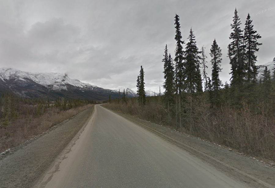
Dalton Highway (Alaska) – Remote, Rugged, and Relentless
Switching gears to the far north, the James W. Dalton Highway in Alaska is in a class of its own. Extending 414 miles from Fairbanks to Deadhorse near the Arctic Ocean, the Dalton (also known as the Haul Road) is mostly gravel, extremely isolated, and subject to some of the harshest weather on the planet. It was built as a supply road for the Trans-Alaska Pipeline and is still primarily used by trucks serving oil fields. The Dalton is often cited as the most dangerous road in North America due to its remoteness and conditions. While exact accident statistics are hard to come by (low traffic means fewer total crashes than urban roads), the consequences of any accident are magnified – help can be tens of miles away, and even a breakdown can become life-threatening in winter.
Road Conditions: Only about 109 miles of the Dalton are paved; the rest is dirt and gravel. The road surface is rough, with potholes and washboard sections that can knock a vehicle around. Gravel roads also mean flying rocks – passing trucks can kick up rocks that shatter windshields or headlights. Drivers often install headlight guards and carry spare windshields or repair kits for this reason. In summer, dust clouds billow up, reducing visibility to near zero when trucks pass, effectively a “brownout” similar to a dust storm. In rain, the road turns to slick mud. In winter, it’s ice and hard-packed snow for hundreds of miles. The Dalton features steep grades up and down the Brooks Range, including the infamous Atigun Pass (4,739 feet) where grades reach 12-16%. Atigun Pass is often battered by blizzards and avalanches, and crossing it can be extremely treacherous – trucks have been blown off the road by winds or stuck in snow.
Isolation and Lack of Services: There are only three settlements with fuel on the entire 414-mile route: Coldfoot (halfway), Wiseman (near Coldfoot, limited services), and Deadhorse at the end. No towns, no gas, no food in between. If you crash or break down in the middle, you might be 100+ miles from the nearest help. There’s no cell service for most of it. Truckers and the Bureau of Land Management maintain CB radio communications and some emergency phones exist, but casual drivers are often truly on their own. Emergency response is minimal; a medevac helicopter might be the only way to get a severely injured person to a hospital in Fairbanks, weather permitting. Given these factors, a minor accident (like sliding into a ditch) that on another road would be a simple tow could become a multi-day ordeal on the Dalton. The U.S. Department of the Interior explicitly publishes rules for Dalton travelers: always yield to big trucks (they have right of way), keep headlights on at all times (for visibility), don’t stop on the road, and carry survival gear.
Weather Extremes: Above the Arctic Circle, winters are brutal. Temperatures of -40°F (which is -40°C) are common, with wind chills even lower. Exposed skin can freeze in minutes. In such cold, car batteries die, fuel can gel, tires become brittle, and any mechanical issue is exacerbated. Conversely, in summer, the sun never sets, which can mess with drivers’ sleep cycles. Mosquitoes swarm any stopped vehicle – a different kind of hazard but one that has driven people crazy enough to make mistakes. The uneven thawing of permafrost also causes road heaves – sudden bumps or dips that can launch a speeding vehicle airborne if one isn’t careful.
Notable Challenges: One notorious stretch is the Yukon River crossing – the Dalton has a bridge over the Yukon, but north of it there’s a segment called “Roller Coaster Alley” for its series of steep hills. Trucks sometimes struggle here in winter. Another is Ice Cut, a section often shaded and iced over. And of course, Atigun Pass as mentioned is a graveyard for many vehicles. Despite the dangers, there are adventurers who take on the Dalton, especially in summer when the scenery is stunning and the daylight endless. Tour companies even run guided trips. “Ice Road Truckers,” the TV show, further popularized it. But all emphasize one point: preparation is absolutely critical.
Safe Travel on the Dalton: If you’re not a seasoned off-road or winter driver, don’t go alone. Ideally, travel in a small convoy so you can assist each other. Carry survival supplies: food, water, warm clothing or sleeping bags, first aid, tools, spare tires (multiple), fuel, etc.. The Dalton has long stretches with no guardrails on massive drop-offs and no lane markings, so drive slowly and cautiously, especially when cresting hills or rounding bends – stay on your side as trucks may be coming. Use CB radio to communicate with truckers (“calling out” mileposts to alert oncoming traffic to your presence). It’s wise to check in at the Yukon River or Coldfoot ranger station for any updates on conditions ahead. Obey any road closures – when the state closes the Dalton due to weather, it’s for good reason. One upside: wildlife like caribou, musk ox, and even polar bears (near Deadhorse) can sometimes be spotted, but keep eyes on the road and save wildlife watching for stops. The Dalton Highway is less about crash statistics and more about inherent risk: it’s dangerous because it’s so unforgiving of mistakes. Those who tackle it successfully often do so by being well-prepared, cautious, and respectful of the Arctic’s power.
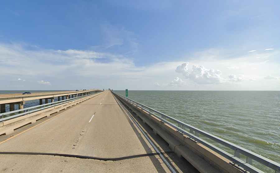
Lake Pontchartrain Causeway (Louisiana) – Longest Bridge Over Water, Foggy Fright
Spanning an astonishing 24 miles across Lake Pontchartrain in Louisiana, the Causeway Bridge holds the title of the world’s longest continuous bridge over water. It’s an engineering marvel – two parallel spans connecting the New Orleans suburbs on the north shore with the city on the south. Yet the Lake Pontchartrain Causeway can be perilous, mainly due to its unique exposure and design. Drivers spend roughly half an hour over open water with no exits and, crucially, no shoulders or emergency pull-offs for most of its length. This means any incident on the bridge can rapidly escalate into a major accident, as there’s simply nowhere to go.
Accident Patterns: The Causeway has seen numerous multi-vehicle crashes, especially in foggy conditions. Dense fog is common over the lake, and when visibility drops, drivers sometimes fail to slow down, resulting in chain-reaction rear-end collisions. A particularly severe event occurred in February 2017, when six separate crashes involving about 50 vehicles happened on the Causeway on a foggy morning, injuring 33 people. The bridge had to be completely shut down. Many drivers remarked that one moment they were driving at speed, the next they were in a wall of fog and smashed into cars that suddenly appeared. Authorities have since improved fog warning systems and will pace traffic across with police escorts in extreme fog, but sudden patches can still catch people out.
Another frightening statistic: since the Causeway’s opening in 1956, at least 18 vehicles have gone over the edge into the lake (as of recent counts) during accidents. The bridge rails historically were low, making it possible for a car or truck to vault over with enough force. In 1994, a tragedy where a pickup went over and fatalities ensued prompted a retrofit: the rails were raised by 18 inches. This greatly reduced – but not eliminated – the chances of going over. Even after upgrades, occasional incidents see vehicles in the water; for example, in 2016 a truck plunged off but the driver miraculously survived. If you do go over, survival depends on seatbelts, how the vehicle lands, and rescue speed – the water is 15-20 feet deep and dark (and home to alligators). Thankfully, Causeway police have boats ready and regular patrols, but it’s a nightmare scenario.
Design Limitations: The lack of shoulders is a key factor. If a car breaks down or a minor fender-bender occurs, it can’t pull out of traffic lanes. This often leads to secondary crashes as approaching vehicles come upon the stopped car unexpectedly. The bridge has periodic crossovers where police can turn around or where breakdowns can be moved, but these are far apart. The Causeway Commission did install emergency breakdown lanes on seven segments (about one every 3½ miles) in a recent upgrade, but if you can’t reach one, you’re stuck in a live lane. Also, the bridge is flat and almost level with the lake – during high winds or storms, waves have been known to splash onto the roadway. In extremely severe weather (like hurricanes), the bridge is closed, but sudden squalls can make for frightening crossings with water and wind buffeting vehicles.
Traffic and Speed: The Causeway speed limit is 65 mph (55 mph at night). Many commuters use it daily, and there’s a tendency to speed, especially given the monotony of the drive. Causeway police strictly enforce the limit after a pattern of high-speed crashes was noted. Still, speeding and following too closely are common factors in the rear-end collisions.
Staying Safe on the Causeway: Before crossing, check the weather – if fog is reported, consider delaying your trip or using alternate routes around the lake. If caught in fog on the bridge, slow down significantly, turn on headlights and fog lights, and avoid changing lanes. In heavy rain, be cautious of hydroplaning; slight water ponding can occur. Always wear your seatbelt – aside from the obvious, if the worst happens and you go over, a seatbelt can prevent head injury on impact and give you a chance to escape the vehicle. Keep a safe distance from the car ahead; the vast openness can distort your sense of speed and spacing. If your vehicle malfunctions, turn on hazard lights and try to limp to the next crossover or breakdown bay. If that’s impossible, stay in your car with seatbelt on (to protect from getting hit) and call Causeway police via emergency call boxes or phone if you have service – help will come escort you off or tow you. Remember, the Causeway is safe 99.9% of the time and tens of thousands cross it daily without incident. It’s those rare but severe incidents that give it its dangerous reputation, and those usually boil down to weather and driver error. Stay alert and respect the conditions, and you can enjoy the convenience of this remarkable bridge safely.
US Highway 2 (Montana) – The Loneliest Road’s Lethal Statistics
In the vast expanse of Montana, US Highway 2 has earned a dubious distinction. This mostly two-lane highway runs across the northern tier of the state, through small towns and a whole lot of empty prairie. What’s startling is that US-2 has one of the highest fatality rates per miles driven in the entire nation. The Center for Excellence in Rural Safety once flagged Montana’s US-2 as having an “abnormal fatality rate” – easily the highest in the country. The reasons highlight the challenges of rural driving: extreme remoteness, delayed emergency response, high speeds, and low seatbelt use.
The Numbers: It’s not that US-2 has more crashes than urban highways; in absolute terms, it doesn’t. But measured per vehicle mile traveled, fatalities are off the charts. A big factor is emergency response time. Along much of US-2 in Montana’s far north (dubbed the Hi-Line region), towns are few and far between. If you crash, you might wait on average 80 minutes for an ambulance to arrive. That’s an eternity compared to urban areas where help might come in 10 minutes. Those golden minutes often mean life or death. Serious injuries that might be survivable with prompt care can turn fatal by the time medics arrive and then transport the victim a long distance to a hospital.
Road and Driver Factors: US-2 is mostly straight and undivided, with a speed limit of 70 mph (65 at night). Drivers often go faster given the open feel. Fatigue is a concern – driving alone for hours on arrow-straight roads can lead to microsleep or inattention. Drifting over the center line causes devastating head-on collisions; with no median and sometimes no rumble strips, nothing prevents a momentary lapse from becoming a tragedy. Seat Belt usage in this rural area has historically been low (Montana has struggled with seatbelt compliance). The Advocates for Highway Safety noted only about 74% usage in Montana versus 90%+ in some states. Many fatal ejections on US-2 and similar roads could have been prevented by belts. Alcohol impairment is another factor – rural areas see a lot of pickup truck single-vehicle rollovers late at night, often involving drinking. On US-2, rolling your vehicle at high speed is especially dangerous because if you’re alone and injured, it could be hours in freezing cold or summer heat before someone finds you.
Harsh Weather: Northern Montana experiences brutal winters. Blizzards can create whiteout conditions on US-2, and drifts can cover the highway. Vehicles sliding on ice or getting stuck in snow far from assistance pose a mortal danger from exposure. Conversely, summer can bring deer and other wildlife onto the road. Hitting a deer at 70 mph can destroy a vehicle and injure occupants; trying to swerve can lead to rollover. With little traffic, an accident at night might not be discovered until morning.
Lolo Pass and Mountain Sections: While a lot of US-2 in Montana is flat plains, parts in the western mountains are curvy and challenging (e.g., Marias Pass on the Continental Divide). And further west, US-2 skirts Glacier National Park, where tourists unfamiliar with the road add to risk. Lolo Pass, on US-12 as mentioned in a Montana context, is another route entirely but shares similar traits: winding roads, scant guardrails, and big drops – but US-2’s main signature is really the flat lonely stretches where monotony and isolation are the killers.
Safety Strategies: If you drive US-2 across Montana, prepare as if you won’t see a gas station for ages (often true). Carry water, food, warm clothes, and a first aid kit. Let someone know your travel plans and schedule so if you don’t show up, they can alert authorities. Absolutely wear your seatbelt – nearly half of Montana’s road fatalities involve unbelted occupants, a preventable statistic. Avoid driving US-2 at night due to wildlife and the difficulty of being seen if you have an accident. Take breaks to stay alert; even a 5-minute stop to stretch every hour or two can ward off highway hypnosis. If you have a satellite phone or emergency beacon, consider bringing it since cell coverage is spotty. Lastly, keep your speed reasonable. It might feel like you’re alone on the moon out there, but physics still applies – the faster you go, the worse the outcome if something goes wrong. US-2’s danger lies in its deceptive simplicity; treat it with respect and caution, and you can enjoy the Big Sky scenery safely rather than becoming another statistic on this “lonely road.”
Pacific Coast Highway (California SR-1) – Scenic Bliss, Steep Cliffs, and Speed Traps
California’s State Route 1, better known as the Pacific Coast Highway (PCH) in Southern California or Highway 1 along the Central Coast, is famous worldwide for its stunning ocean views. But that beauty masks significant danger. The PCH hugs coastal cliffs, features narrow, winding sections (especially through Big Sur), and traverses major urban areas like Los Angeles and Orange County where it turns into an urban arterial road. Over the years, certain segments of SR-1 have seen a high number of fatal accidents. For example, a 21-mile stretch of PCH in Malibu saw 49 fatalities between 2012 and 2022, largely due to speed and unsafe passing. Overall, the Pacific Coast Highway combines two risk profiles: (1) a twisty, low-speed but high-consequence rural road and (2) a busy, high-speed city boulevard.
Cliffside Driving in Big Sur: The segment through Big Sur (between San Luis Obispo and Carmel) is often cited as one of America’s most dangerous – in part because any mistake could send you plummeting hundreds of feet to the rocks or ocean below. This area has very sharp turns marked at 15-25 mph, blind corners, rockfall hazards, and no shoulders. Tourists unfamiliar with the road sometimes panic or, conversely, sightsee too much and drift into the opposing lane. There are also frequent closures from landslides – the massive Mud Creek slide in 2017 wiped out a portion of highway. When the road is open, landslide-prone areas can leave debris on the roadway. Weather can bring dense fog off the Pacific, suddenly limiting visibility to a few car lengths. Locals know to drive cautiously, but every year there are stories of vehicles going over the edge. Rescue in such cases is extremely difficult – often involving helicopters and search teams rappelling down cliffs. Not all these incidents make the news, but they do happen with unfortunate regularity.
Urban PCH Challenges: In places like Malibu (northwest of Los Angeles), PCH straightens out and the temptation is to drive fast. However, it’s lined with beaches, businesses, and homes, meaning driveways and pedestrian crossings. Many of Malibu’s 49 fatalities were pedestrians or cyclists struck by vehicles. Speeding is a chronic issue – drivers leaving LA heading up the coast often maintain freeway speeds on PCH, not anticipating someone might turn or stop for a surf spot. Malibu’s city government has pushed for measures like speed cameras due to the persistent problem. Farther south, through Orange County and San Diego, PCH (as Coast Highway) goes through dense communities like Laguna Beach, where traffic is heavy, and yet people still speed or drive distracted, leading to crashes. Intersections along these urban stretches can be dangerous due to limited sight lines (think of coming around a curve with the sun in your eyes and suddenly there’s a crosswalk).
Tourist Drivers and Rentals: Because PCH is a bucket-list drive, you have a lot of drivers who are either inexperienced on mountain roads or driving rental cars they aren’t used to. RVs and camper vans also frequent PCH, especially in summer, and can hold up traffic. This sometimes causes impatient drivers behind to attempt risky passes on two-lane sections. Many head-on collisions on rural parts of SR-1 start with an impatient pass on a blind curve or hill.
Weather and Natural Events: Besides fog, note that rain can make coastal roads very slick (oils accumulate during dry periods, then water brings them up). Wind in some open sections can push cars, particularly high-profile vehicles, toward the opposing lane. Erosion is constant – one day the road edge might crumble a bit, narrowing the lane unexpectedly. Also, earthquakes (it’s California after all) have on rare occasions caused rockfalls on coastal highways, though SR-1 has never seen a major quake destruction like freeways have.
Safety Tips on PCH/SR-1: If you’re doing the classic road trip, don’t treat it as a race. Savor the scenery by going the speed limit (or less where appropriate). Use turnouts to let faster locals by. Keep your eyes on the road – designate a passenger to be the sightseer or use official vista points to stop and look. In Malibu and other developed areas, obey the posted 45 or 50 mph limits and be ready to stop for lights and pedestrians. At night, be extra careful – stretches of SR-1 have no lighting, and it’s easy to misjudge a curve or not see a pedestrian until too late. Watch for cyclists by day; many enjoy the route, and on narrow sections they can be a surprise around a bend. If foggy, use fog lights if you have them and low beams, and give yourself plenty of distance to react. And remember that many PCH tragedies involve drunk driving – whether it’s a night out in Santa Monica or a wine tasting in Big Sur gone wrong. Don’t drive under the influence, and be defensive assuming others might be – particularly after sunset near towns. By balancing enjoyment with caution, you can safely navigate the gorgeous but demanding Pacific Coast Highway.
Kahekili Highway (Hawaii) – Maui’s One-Lane Cliff Road
Hawaii offers its own slice of dangerous-road heaven. Kahekili Highway (State Route 340) on West Maui is often dubbed “Hawaii’s most dangerous road.” Despite being only about 20 miles long, it has gained notoriety for its incredibly narrow, winding path along volcanic cliffs, where in places it’s barely one lane wide with blind curves and no guardrails. Rental car contracts often forbid driving this road, and for good reason – numerous visitors have run into trouble here. Tragically, several people have lost their lives on Kahekili Highway in recent years, and many more have experienced harrowing near-misses.
Road Characteristics: Kahekili Highway loops around the rugged northwest coast of Maui, from Kapalua to Wailuku. Much of it is a legacy of an old donkey trail. You’ll encounter sections where the road is essentially a single lane carved into a cliff – if two vehicles meet, one may have to reverse to a wider spot (which could be hundreds of feet back) to let the other pass. Locals have a protocol of honking briefly before blind corners to alert oncoming drivers. The road surface is paved but often bumpy and very close to the edge. There are spots with vertical drops of a thousand feet down to the ocean. No guardrails for most of it, meaning zero protection if you misjudge a turn. Some portions are under a constant rockfall hazard – fallen rocks or debris on the road can force sudden maneuvers. Additionally, being Hawaii, when it rains, waterfalls may flow across the road or cause washouts on the cliffside. And when it’s dry, there’s still the challenge of navigating hairpin turns where the radius is so tight you might need a three-point turn if you’re in a long vehicle.
Driver Behavior and Incidents: Many accidents on Kahekili involve rental car scrapes against the cliff or collisions with other vehicles due to its tightness. However, there have been fatal accidents where cars have actually gone off the road. In January 2021, a woman’s car plunged off a cliff on Kahekili, killing her. Another crash that year killed a 17-year-old driver who was reportedly speeding. Residents have expressed concern about drivers going too fast on this road and have pushed for safety measures. The state DOT has talked about added speed bumps or warning signs. Yet infrastructure improvements are tough given the geography; one can’t simply widen the road without enormous expense and environmental impact. The highway has seen some resurfacing and repairs in the last decade, but it remains fundamentally narrow and dangerous.
Beyond car accidents, the road poses other risks: If you have to back up to yield, one false move could be disastrous. Tourists not used to driving on the right (e.g., visitors from left-driving countries) have made mistakes on these skinny lanes. And then there’s simple fear – panic can set in when a driver realizes the predicament, causing them to freeze or make poor decisions. Emergency response is relatively slow; while not as isolated as the Dalton Highway, getting a tow truck or ambulance to the middle of Kahekili Hwy takes time. For instance, if a car goes over, extraction is very challenging – it may require rope teams or helicopters depending on the location.
Comparison to Road to Hana: Many hear about the famous Hana Highway (also on Maui), but while Hana’s road is also curvy and narrow, it has two lanes (mostly) and guardrails in risky spots. Kahekili is far more primitive and risky. Some locals even call it the “real road to Hana” for thrill-seekers – but this is somewhat tongue-in-cheek, as its purpose is as a county route for remote communities, not a tourist attraction.
Driving Kahekili Highway Safely: The best advice often given: if you’re not completely confident, don’t drive it. Take a guided tour or simply turn around and go back the way you came. If you do proceed, go slow. Like 10-15 mph in many places. Honk on blind curves. Be prepared to reverse – practice backing your car straight for a distance before you attempt this road, because you may need that skill. Yield to local traffic; locals who use this road for daily life know its quirks better and often drive it faster – let them pass at the first opportunity. Avoid this road in the rain or at night entirely. One travel reviewer’s quote summed it up: “the worst point was teetering inches from a steep cliff with 3 cars coming toward us… I’ve never been so close to death”. Not exactly an endorsement, but a valid warning. If you feel your nerves giving in, find a wider spot and turn around rather than press on in panic. There are a few tiny villages along the way (Kahakuloa, etc.) – drive respectfully slowly through them and be mindful of pedestrians or animals. Ultimately, Kahekili Highway can be a spectacular journey with amazing views of Maui’s rugged coast, but it must be approached with extreme caution and humility. It’s a road where locals pray tourists will use common sense. Countless successful crossings happen every week, but the margin for error is zero – and that’s what makes it one of the most dangerous roads in the USA.
From the sun-baked deserts of Arizona to the fog-laden bridges of Louisiana and the icy passes of Colorado, America’s roads present a vast array of dangers. We’ve explored highways notorious for high fatality counts and byways famed for their treacherous conditions. What emerges is that no single factor makes a road deadly – it’s often a combination of road design, environment, and driver behavior. Interstate highways like I-95, I-4, and I-15 carry huge volumes at high speeds, so when mistakes happen, they happen big. Mountain roads like US-550 or Tail of the Dragon demand skill and respect; they punish complacency swiftly. Rural highways (US-2, US-17) show that even seemingly simple roads can be perilous when isolated or outdated. And unique structures like the Lake Pontchartrain Causeway remind us that even a straight flat bridge can become a site of chaos under the wrong conditions.
So what can drivers do? Preparation and caution are paramount. Simple steps like planning your route and checking weather, ensuring your vehicle is road-worthy (good brakes, reliable tires suited to the terrain and weather – e.g., using off-road tires for unpaved routes or winter tires on snowy roads), and staying alert can tip the odds in your favor. On any dangerous road, slow down and give yourself more time to react. Buckle up and minimize distractions – these are basic but life saving habits. If a road has a fearsome reputation, don’t assume it's an exaggeration: heed the warnings, whether from officials or locals. Many of these roads can be traveled safely if one is prepared (people commute on them daily), but they are unforgiving of lapses.
Lastly, remember that while the roads themselves pose challenges, it’s often driver choices that make the difference. Responsible driving – sober, alert, and defensive – will drastically reduce your chances of becoming another statistic on a deadly road. This article has given you the data and stories to illustrate the stakes. Armed with this knowledge, approach these routes with appropriate care. By respecting the roads and their hazards, you can still enjoy the journey while maximizing your safety. Stay safe out there, and happy (careful) travels on America’s roads.