Driving the Steep Road to Mariepskop
Mariepskop is a high mountain peak at an elevation of 1,942m (6,371ft) above sea level, located in South Africa. It’s one of the greatest drives in the country. Driving up the mountain is not for the faint-hearted or learner drivers.
Where is Mariepskop?
The peak, also known as Marepe or Maripekop, is located on the boundary between Mpumalanga and Limpopo provinces, in the northeastern part of the country.
Why is it Called Mariepskop?
Set high in the Mariepskop Nature Reserve, the mountain is named after 19th-century Pulana chief, Maripe Mashile, whose tribe used the mountain as a stronghold.
What’s at the Summit of Mariepskop?
Mariepskop is the highest peak in the northern Drakensberg Escarpment. The view at the summit is fantastic—on a clear day, you can see the Indian Ocean and Maputo. The summit hosts various government installations, including an SAAF Radar installation, fire look-out points, and microwave technology. A radar station was built in the 1950s to serve the South African Defence Force. While the radar station remains operational, most of the original buildings have been replaced by modern radar equipment.
How Long is the Road to Mariepskop?
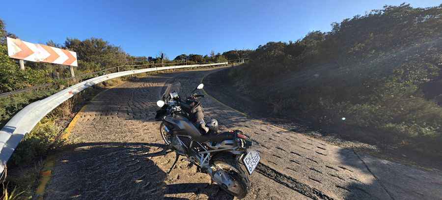
Starting from Moloro, the road to the summit is 20.2 km (12.5 miles) long. Over this distance, the elevation gain is 1,253m, and the average gradient is 6.20%. It is not advisable to drive the road during the rainy season or if the road is wet.
Is the Road to Mariepskop Paved?
The road to the top of Mariepskop is a gravel road with some paved and concrete sections. A high-clearance vehicle with good traction is required, and 4x4 vehicles are recommended. The last 7 km of the road is a concrete road with a steep gradient of 33% in some places. However, the concrete road is relatively safe to drive, as there are no sheer drop-offs.
Pic: Mark Attree