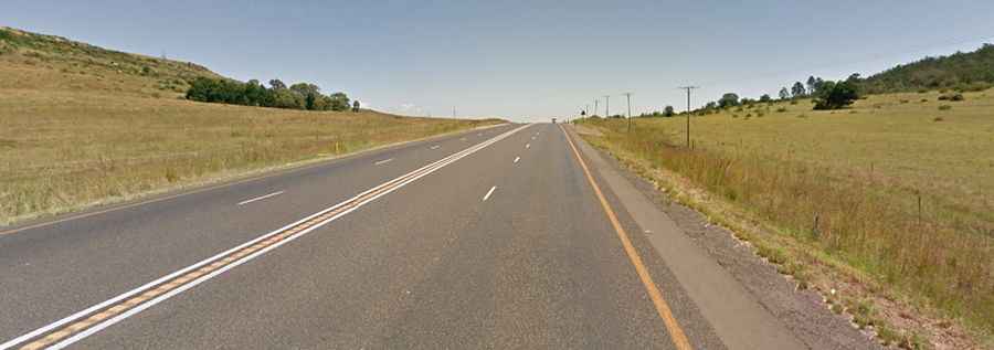
A dangerous paved road to Van Reenen's Pass in South Africa
Van Reenen's Pass is a high mountain pass at an elevation of 1.777m (5,830ft) above sea level, located in the Free State province of South Africa. This pass produces a fair portion of South Africa’s trucking accidents.

Where is Van Reenens pass?
Set high in the Drakensberg mountains, on the northeastern part of the country, the pass, also known as Van Reenenspas, is located near the border of KwaZulu-Natal and the Free State.
When was the road to Van Reenens pass built?
The first road through the pass was planned in 1856 and it was named after Frans van Reenen.
Is Van Reenens pass paved?
The road to the summit is totally paved. It’s called N3, the main route from Durban to Johannesburg.
How long is Van Reenens pass?
The pass is 52.3 km (32.49 miles) long running from Harrismith (in the Free State province) to Sand River Valley (in Kwa Zulu-Natal province).
Is Van Reenens pass worth the drive?
To drive the road without stopping will take most people between 40 and 50 minutes. The pass provides beautiful scenery as it descends to Ladysmith.
Is Van Reenen's Pass dangerous?
It’s said to be one of the most dangerous road roads of the country. Traffic is heavy, and trucks use the pass unceasingly. It is often the scene of accidents and reckless driving. The steepest sections of the road are around 1:20.
Is Van Reenen's pass closed?
Access to the pass is typically open all year round, with the occasional closure in winters due to dangerous weather conditions. When bad weather arrives, things can get nasty with heavy snowfalls occurring during the winter cycle and the pass will be temporarily closed to traffic at times. The often wet, misty weather conditions have given this pass the reputation of being perilously slippery, with decreased visibility. The winds are capable of blowing light trucks or even caravans onto their sides.