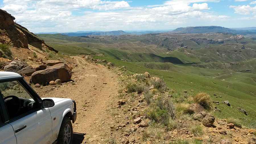
An epic enthralling road to Baster Voetslaan Pass
Baster Voetslaan Pass is a high mountain pass at an elevation of 2.240m (7,349ft) above the sea level, located in the Eastern Cape of South Africa. Avoid the pass entirely when it is wet, as conditions get slippery at best.

Is Baster Voetslaan Pass unpaved?
The road to the summit, also known as Baster Voetpad, Bastervoetpad Pass and Dr. Lapa Munnik Pass, is totally unpaved. The road combines technical driving with stunning views.
Is Baster Voetslaan Pass challenging?
The road is rough in places and to complete the drive you’ll need a proper 4x4 vehicle with low range and high ground clearance. Under no circumstances should you attempt to drive this pass in a conventional vehicle. The drive is not for the sissies as it winds its way through some spectacular mountainous terrain. It is a true adventurer’s pass with some vertigo inducing drop-offs and very rough sections. There are some very steep and slippery sections at a gradient of 1:4.
How long is Baster Voetslaan Pass?
The pass road is 35.3 km (21.93 miles) long, running west-east from R393 road to R56 road. The area is really remote. It is named after a breakaway group of freed slaves who made their way down this tricky pass to a new settlement near Ugie.
Is Baster Voetslaan Pass open?
Set high in the Eastern Cape Highlands, in the winter months this pass is frequently closed under heavy snowfalls, when it can become treacherous. In bad weather it’s subject to electrical storms, violent winds, heavy rain, hail and snow.
Pic: Willem Schoeman