A challenging drive to Naude's Neck Pass in SA
Naude's Neck Pass is a high mountain pass at an elevation of 2.592m (8,503ft) above sea level, located in the Eastern Cape province of South Africa. This pass is not for the faint-hearted, and even in full 4WD, vehicles can slide around on the muddy surfaces. It’s one of the highest roads of South Africa.
Where is Naude's Neck Pass?
The pass is located at the southern end of the Drakensberg mountains in the northeastern part of the Eastern Cape.
Why is it called Naude's Neck Pass?
The pass is named after the Naudé brothers, who built a rough track across the mountains in 1896.
When was the road through Naude's Neck Pass built?
In 1911, George Mandy, a road engineer, constructed a military road along this route.
Is the R396 to Naude's Neck Pass tarred?
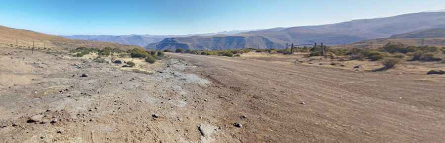
The road to the summit, also known as Naudes’ Nek Pass and Naudésnek Pass, is totally unpaved. It’s called R396. The twisting gravel road is quite curvy and steep. This is off-the-beaten-track driving. Even in a 4x4, the road presents a challenge, particularly in winter when snowfalls are common, making the roads slippery. And the road is not in good shape, although some advocate that an ordinary car with high clearance can manage the summit.
How long is the road to Naude's Neck Pass?
The pass is 103 km (64 miles) long, running from Rhodes to Maclear. Today, the road, surrounded by icy air and rugged terrain, is more commonly traveled in a comfortable 4x4 vehicle, but it still presents a challenge, particularly in winter when heavy snowfalls are common. Local advice regarding weather and road conditions should be heeded before attempting this spectacular pass. The road is steep and hits a 1:7 maximum gradient through some of the ramps.
How long does it take to drive Naude's Neck Pass?
To drive the road without stopping will take most people between 3 and 4 hours. However, you should allow about 4.5 hours for this drive, including photo stops, and more in bad weather.
Pic: Jacques Venter