Driving on One of the Worst Roads in Mozambique from Inchope to Gorongosa
Straddling Manica and Sofala provinces of Mozambique, the road from Inchope to Gorongosa is said to be one of the worst in the country.
What’s Mozambique Highway?
Located in the central part of the country, the road is part of Mozambique’s national highway number 1 (EN1), locally known as Mozambique Highway. It’s a main route in the country, with a total length of 2,471.2 kilometers. The first sections of the road were opened to heavy goods vehicles in 1963.
How long is the road from Inchope to Gorongosa?
The drive is 73.9 km (45.91 miles) long, running north-south from Gorongosa (the administrative center of Gorongosa District) to Inchope.
Is the road from Inchope to Gorongosa paved?
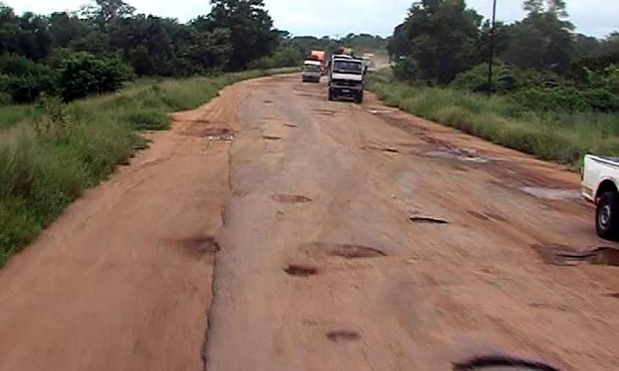
The road was originally paved, but due to the lack of maintenance, the road has extremely bad conditions, with big potholes here and there. Driving conditions may be hazardous during the rainy season from December to April, and sometimes near-zero visibility poses a threat. There are plans to improve the road shortly.
Can I drive the road from Inchope to Gorongosa?
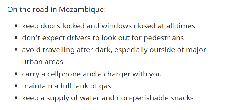
Remember to exercise a high degree of caution if traveling to the country due to crime, kidnapping, and threat of terrorism. Some areas have greater risk. There have been violent attacks against vehicles, especially trucks and buses, along sections of the highway resulting in serious injuries and deaths. The country has seen an increase in road accidents, robberies, theft, and assaults targeting truck drivers and travelers. And during your trip, remember avoid traveling alone, especially at night; keep your doors and windows locked at all times and if threatened by robbers, don’t resist.
How’s driving in Mozambique?
Pic: https://aimnews.org/2023/01/20/850-million-dollars-guaranteed-for-en1/