Driving the Challenging Road R307 in the High Atlas Mountains
Located in the central part of Morocco, the defiant R307 is a quiet, twisty road, sometimes turning into a track, running through the High Atlas mountain range.
When Was Road R307 Built?
The road straddles Azilal and Ouarzazate provinces and was built by the French government at the beginning of the 20th century. It’s one of the most stunning yet challenging drives in the country, offering breathtaking views.
Is Road R307 Paved?
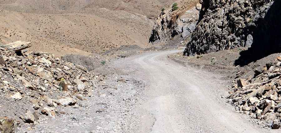
In theory, the road is paved/tarmacked for the whole distance, but in practice, parts of it disappear after bad weather. Some sections can be debris-strewn. There is a risk of falling rock, several parts without guardrails, hundreds of curves, and often only enough space for a single car in opposite directions. The road condition deteriorates in the mountains, and after winter, it can be quite tough.
How Long is Road R307?
The drive is 142 km (88.23 miles) long. The journey runs north-south, linking the villages of Demnat (Azilal Province, Béni Mellal-Khénifra) and Ouarzazate (Ouarzazate Province, Drâa-Tafilalet). Issues can arise in the tight hairpins where water erosion has broken the pavement or scattered rocks and debris.
Can I Drive My Vehicle on Road R307?
A 4x4 or a high-clearance vehicle might be useful. It’s dangerous after rains due to potholes. The road is very scenic and passes through remote and isolated old villages.
How Challenging is Road R307 in Winters?
The weather at around 2,000 meters is highly changeable. Rain or snow can make the road extremely difficult. The highest elevation of the journey is 2,194m (7,198ft) above sea level, climbing several mountain passes, including:
- Tizi n'Fedhrat, at 2,145m (7,037ft) above sea level
- Col D'Azwin, at 2,173m (7,129ft) above sea level
- Tizi n'Outfi, at 1,944m (6,377ft) above sea level
Pic: Roei ben moshe