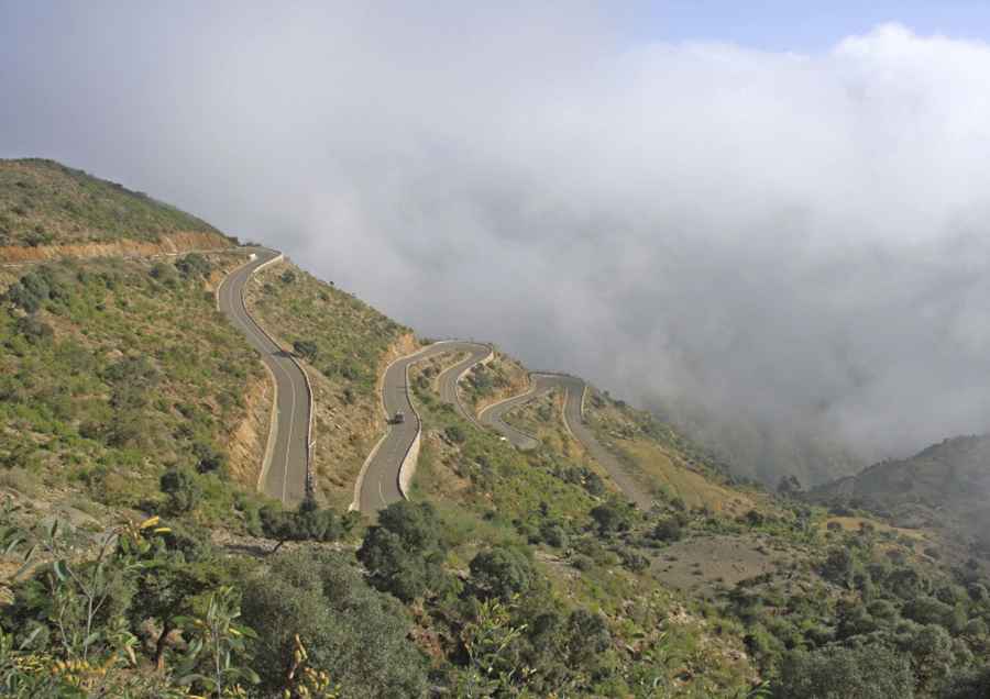
Driving the Semenawi Bahri Tollway: A Scenic Route in Eastern Eritrea
The Semenawi Bahri Tollway is a unique drive through Eritrea’s Semenawi Bahri National Park, known for its sharp turns, elevation, and stunning views.

Where is the Semenawi Bahri Tollway?
This road runs through the Maekel and Northern Red Sea regions of Eritrea within Semenawi Bahri National Park. The park is home to diverse wildlife, including leopards, bushbucks, klipspringers, kudu, duiker, and warthogs. The road descends towards the coast, with areas where drivers find themselves “driving into the clouds” on misty days—a striking experience as the route twists through dense forest.
Why is the Semenawi Bahri Tollway Important?
The road crosses Eritrea’s green belt region, which experiences two rainy seasons each year, keeping the area green and densely forested. At the start of the drive, a sign reminds visitors to “Take nothing but photos, leave nothing but footprints,” underscoring the importance of preserving this area. The Eritrean government also uses the area’s foggy climate for fog harvesting to help manage water shortages.
When Was the Semenawi Bahri Tollway Built?
The fully paved road was completed in 2002, with a cost of 360 million Nakfa. Since then, it has become a popular route for travelers heading to Massawa.
How Challenging is the Semenawi Bahri Tollway?
With over 40 hairpin bends and a maximum elevation of 2,570m (8,431ft) above sea level, this route requires caution, especially for larger vehicles. Road widths range from 10 meters in wider areas to 6 meters at the narrowest points, with a steepest incline of 11%. Fog is frequent, adding another layer of challenge.
How Long is the Semenawi Bahri Tollway?
The road is 65.3 km (40.57 miles) long and runs from Serejeka to Shebah, serving as an alternative to the old P1 Road from Asmara to Massawa.
Road suggested by: jorge manuel gómez sánchez
Pic: Christian Vigna