The wild unpaved road to Mount Chelia
Mount Chelia is a high mountain peak at an elevation of 2,293m (7,522ft) above sea level, located in the northeastern part of Algeria.
Where is Mount Chelia?
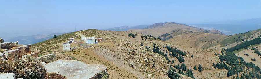
The peak is located on the boundary between Khenchela and Batna provinces, within the Parc National de Chélia. At the summit, there are a few abandoned buildings.
How challenging is the road to Mount Chelia?
Set high in the Aurès Mountains, the road to the summit is completely unpaved. It has narrow sections, steep inclines, and requires a 4x4 vehicle. The road is difficult to navigate. The area typically experiences hot summers and a cold winter climate. After rain—even a single downpour—the road conditions can become extremely challenging.
How long is the road to Mount Chelia?
Starting from the paved road to Col de Bouhmama, the road to the summit is 7.6 km (4.72 miles) long. Over this distance, the elevation gain is 559m, with an average gradient of 7.35%.
Pic: Ahmed Rouibi