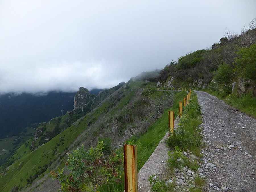
Spina Pass is an adventure track you will never forget
Passo della Spina is a high mountain pass at an elevation of 1.521m (4,990ft) above sea level, located in the province of Brescia, in the Lombardy region of Italy. The pass is traversed by the spectacular Anfo ridge road.

Is Spina Pass unpaved?
Set high on the slopes of the Orobie Alps, the Anfo Ridge Road is mostly unpaved. The road has 4 short unlit tunnels. It was closed for 6 years because of a landslide, but the route was cleared again in 2009. In 2010, some new tunnels were built to bypass the narrowest parts. It’s an old military route, following an original path back to Roman times. It’s hard, scenic, and beautiful but a bit dusty and stony.
How long is Spina Pass?
Located on the northern part of the country, the road is 20.1km (12.48 miles) long, running east-west from Anfo to Passo del Maniva. The drive has it all: important rockfall risk, unsecured precipices, dangerous drop-offs, tight corners, and a narrow, full of holes way. The road has a maximum grade of 12 percent and the speed is limited to 20 km/h. It is closed to vehicles with a width of 2,50m and a height of 3,20m. It has never had much traffic because of the bad conditions of the road where abundant stones are scattered. Since there was clearly no effort made to make the road again consistently navigable, this state is expected to continue.
Is Spina Pass open?
It’s an exposed high mountain road, climbing up 4 mountain passes: Passo Baremone, at 1.450m (4,757ft) asl; Passo della Spina, at 1.521m (4,990ft) asl, Passo della Berga, at 1.527m (5,009ft) asl, and Passo del Dosso Alto, at 1.727m (5,666ft) asl. The road is usually open from June until the end of October, but can be also closed after heavy rains.
Pic: Nord Pfalz