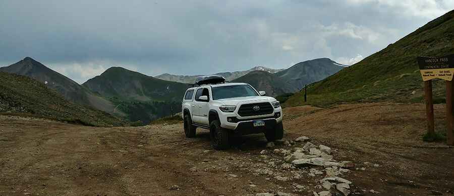
A beautiful road with lots of historical sights to Hancock Pass in Colorado
Hancock Pass is a high mountain pass at an elevation of 3.702m (12,145ft) above sea level, located in the US state of Colorado. This driving route is not only incredibly scenic but also chock-full of mining history. It's one of the highest roads of Colorado.

Where is Hancock Pass?
The pass is located on the boundary between Chaffee and Gunnison counties, in the western part of Colorado.
When was the road to Hancock Pass in Colorado built?
The road to the summit was built in the 1880s related to mining in the area. The pass itself is marked with a continental divide sign.
Is the road to Hancock Pass in CO difficult?
The road to the summit is totally unpaved. It's called Forest Road 839 (south) and Forest Road 299 (north). It’s of moderate difficulty and very rocky and slow going. The road follows an old railroad grade up the mountain and is an easy trail until it finally turns off the rail grade. At that point, the difficulty increases to moderate. It's very rocky and slow-going but okay for aggressive stock SUVs. Skid plates are helpful. The road is narrow and climbs above timberline fairly quickly.
Is the road to Hancock Pass in CO open?
Set high in the Rocky Mountains, this road is usually impassable from late October through late June or early July (depending on snow). It is not generally snow-free until late June or even July in some years. Do not attempt the drive if snow is present. Snow can linger at the pass well into July.
Where does the road to Hancock Pass in CO start and end?
The Hancock Pass 4WD road is 27km (16.8 miles) long and runs from St. Elmo (a ghost town in Chaffee County) to Pitkin (a town in Gunnison County).
Is Hancock Pass worth it?
There is plenty of room to park and take in the views, which are spectacular. The views on the other side of the pass are even better. Surrounded by a high alpine environment, carry adequate supplies and warm clothing even on a hot day.
Pic: Ryan Hodo