What are the most spectacular roads in France?
France is a paradise for the lovers of the most spectacular roads, providing endless experiences for each driver. From stunning balcony roads, mountain passes and coastal drives, to roads disappearing with the tides, it hosts more than 750 roads worth the drive.
Located in the eastern part of Europe, France covers an area of 551,695 square kilometers and shares borders with 7 countries: Belgium, Luxembourg, Germany, Switzerland, Italy, Spain, and Andorra. With high mountains in the Alps and the Pyrenees, the roads of the country are famous worldwide because of the Tour de France, the most important cycling race.
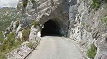
When travelling to the country, be sure to experience a drive through the Best Balcony Roads. Dramatically carved out rock on the side of mountains, the balcony roads are a unique experience for any rider.
The country also hosts iconic roads, known worldwide, including Col du Chaussy, a mountain pass at 1,533m (5,029ft) above sea level, famous for the “Lacets de Montvernier,” a special 3 km stretch with 17 hairpins as the road virtually climbs a cliff; or Col de Turini, a Treacherous Alpine Road with a Legendary Driving History, one of the most dangerous and challenging stages of the Monte Carlo Rally and one of the most scenic drives in the world. For those preferring another kind of experience, don’t forget to drive Passage du Gois, the Tide-Covered Road. It’s a natural passage flooded twice a day by the high tide leading to the island of Noirmoutier.
Driving the D22, a balcony road in France
Perched high above the glistening coastline of the Côte d'Azur in southeast France, the D22 road is the name of the sharply winding and precipitous ascent in a steep and narrow zig-zag road on the French Riviera.
Gorges de la Méouge, a balcony road in France
Gorges de la Méouge is an incredible canyon located in the Hautes-Alpes department in southeastern France. The gorge is 7-kilometre (4.3 mi) long carved by the Méouge which has its source in the Drôme. It’s one of the famous French balcony roads.
Col du Glandon: one of the toughest climbs in the French Alps
Col du Glandon is a high mountain pass at an elevation of 1.930m (6,332ft) above the sea level, located in the Savoie department in the Auvergne-Rhône-Alpes region in south-eastern France. It’s one of the toughest climbs in the French Alps.
Bellecote is one of the highest roads of Europe
Bellecote is a high mountain peak at an elevation of 3.071m (10,075ft) above the sea level, located in the Savoie department in the Auvergne-Rhône-Alpes region in south-eastern France. It’s one of the highest roads of Europe.
Gorges de la Blanche, a balcony road in France
Gorges de la Blanche is an amazing gorge located in the Alpes-de-Haute-Provence department in southeastern France. It’s one of the scenic French balcony roads.
A wild paved road to the top of Col du Négron
Col du Négron is a mountain pass at an elevation of 1.242m (4,074ft) above the sea level, located in the Drôme department in southeastern France.
Gorges de Chouvigny, a balcony road in France
Gorges de Chouvigny is an incredible canyon located in the Allier department in central France. The gorge is carved by the La Sioule river. It’s one of the famous French balcony roads.
Col de l’Holme, a sensational drive
Col de l’Holme is a mountain pass at an elevation of 1.207m (3,959ft) above the sea level, located in the Isère department in southeastern France.
Col de Vé Gautier: good road quality and pleasant grading
Col de Vé Gautier is a mountain pass at an elevation of 1.099m (3,605ft) above the sea level, located in the Alpes-Maritimes department in the Provence-Alpes-Côte d'Azur region of south-eastern France.
The scenic road to Col d’Olivier
Col d’Olivier is a mountain pass at an elevation of 711m (2,332ft) above the sea level, located in the Alpes-de-Haute-Provence department in southeastern France, in the Provence-Alpes-Côte d'Azur region.
Col des Aravis, a road with very nice scenery
Col des Aravis is a high mountain pass at an elevation of 1.487m (4,879ft) above the sea level, located in the Haute-Savoie department in the Auvergne-Rhône-Alpes region in south-eastern France. The pass is traversed by the scenic Route des Grandes Alpes.
The road to Lac de Céma, a drive you'll never forget
Lac de Céma is a high mountain lake at an elevation of 2.745m (9,005ft) above the sea level, located in the department of Savoie in the Auvergne-Rhône-Alpes region of the French Alps, near the Italian border. It’s one of the highest roads of Europe.
Col de Bavella is one of the most scenic roads of Corsica
Col de Bavella is a mountain pass at an elevation of 1.226m (4,022ft) above the sea level, located in the Corse-du-Sud department of France on the island of Corsica. It’s one of the highest roads of Corsica.
An awe-inspiring road to Col du Cap Nestès in the Pyrénées
Col du Cap Nestès is a high mountain pass at an elevation of 1.683m (5,521ft) above the sea level, located in the Hautes-Pyrénées department in south-western France.
Superbagnères, the road continually snakes its way up ahead
Superbagnères is a ski station at an elevation of 1.804m (5,918ft) above the sea level, located deep in the heart of the Pyrenees, in France.
Pointe du Bouchet, a brutal climb
Pointe du Bouchet is a high mountain peak at an elevation of 3.229m (10,593ft) above the sea level, located in the Savoie department, in the Auvergne-Rhône-Alpes region of the French Alps. It’s one of the highest roads of Europe.
Col de la Chaudière: a hairpinned paved road to the summit
Col de la Chaudière is a mountain pass at an elevation of 1.047m (3,435ft) above the sea level, located in the Drôme department in southeastern France
Cirque de Troumouse: a road with 31 hairpin turns
Cirque de Troumouse is a high alpine cirque located in the Hautes-Pyrénées department in south-western France.
Chalet Hôtel du Gioberney, a paved road in the heart of the Écrins Park
Chalet Hôtel du Gioberney is a high mountain refuge at an elevation of 1.649m (5,410ft) above the sea level, located in the Isère department in southeastern France, within the Cirque du Vaccivier.
Belvédère du Viso, an awe-inspiring drive in the Cottian Alps
Belvedere du Cirque du Mont-Viso is a natural viewpoint at an elevation of 2.147m (7,043ft) above the sea level, located in the Hautes-Alpes department in southeastern France, near the Italian border.
Mont du Chat, one of the toughest (paved) climbs in France
Mont du Chat (Cat Mountain) is a brutal mountain pass at an elevation of 1.504m (4,934ft) above the sea level, located in the Savoie department in the Rhône-Alpes region in south-eastern France. It’s said to be one of the toughest (paved) climbs in France, with a 15% gradient in parts.
A steep road (8.20%) to Lac de Plan d’Aval
Lac de Plan d’Aval is a high mountain reservoir at an elevation of 2.041m (6,696ft) above the sea level, located in the Savoie department in the Rhône-Alpes region in south-eastern France.
Col du Grand Colombier, an iconic road in the western Alps
Col du Grand Colombier is a high mountain pass at an elevation of 1.501m (4,925ft) above the sea level, located in the department of Ain in the Auvergne-Rhône-Alpes region of eastern France. The road is very steep, with sections up to 19%.
An Explorer's Guide to the Col de la Bailletta
Col de la Bailletta is a high mountain pass at an elevation of 2.852m (9,356ft) above the sea level, located in the Savoie department (Rhône-Alpes region) in southeastern France. It's one of the highest roads of Europe.
Vallon du Mélézet is an epic road in the Alps
Vallon du Mélézet is a high mountain pass at an elevation of 1.821m (5,974ft) above the sea level, located in the Hautes-Alpes department in southeastern France.
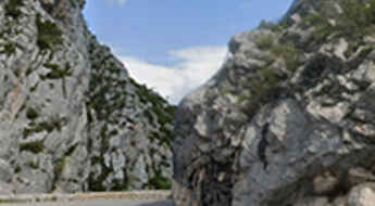
Clue de la Roche Percee is a French balcony road
Clue de la Roche Percée is a narrow canyon located in Southeastern France. It’s one of the famous French balcony roads. Driving on this narrow road through the canyon, between walls of cliffs and gorges, is a delight.
Col de l’Echarasson, a classic road trip in southeastern France
Col de l’Echarasson is a mountain pass at an elevation of 1.146m (3,759ft) above the sea level, located in the Drôme department in southeastern France.
Col de Restefond is an epic road in the Alps
Col de Restefond is a high mountain pass at an elevation of 2.680m (8,790ft) above the sea level, located in the French Alps, within the Mercantour National Park in the department of Alpes-de-Haute-Provence. The pass is located close to Cime de la Bonette.
Gorges du Bachelard, a French balcony road
Located on the road to Col de la Cayolle, in the heart of Mercantour National Park, in the Maritime Alps, France, Gorges du Bachelard is a narrow, rocky canyon crammed with waterfalls, stone bridges, and soaring cliffs.
Col de la Savolière, a curvy paved mountain road to the summit
Col de la Savolière is a mountain pass at an elevation of 1.421m (4,662ft) above the sea level, located in the Haute-Savoie department in the Rhône-Alpes region in south-eastern France.
D918 is a challenging balcony road in France
D918 is an extreme high mountain road located in the Pyrenees, a range of mountains in southwest Europe that forms a natural border between France and Spain. It’s one of the French balcony roads.
Orcières-Merlette, an iconic Tour de France climb
Orcières-Merlette is a ski resort at an elevation of 1.823m (5,980ft) above the sea level, located in the Hautes-Alpes department in southeastern France.
Col de Puymorens, an iconic road in the Pyrénées
Col de Puymorens is a high mountain pass at an elevation of 1.920m (6,299ft) above the sea level, located in the Pyrénées-Orientales department, in southern France close to the northern Spanish frontier and the Mediterranean Sea.
Clue du Riolan, a balcony road in France
Clue de Riolan is one of France's most beautiful canyons. Located in the Alpes-Maritimes department in southeastern France, the canyon is carved by the Le Riolan river. It’sone of the famous French balcony roads.
A military road to Col de Seigneurs
Colle del Lago dei Signori-Col de Seigneurs is an international high mountain pass at an elevation of 2,130m (6,988ft) above sea level, located on the border of Italy and France. The road traversing the pass was originally built for military purposes and was used during World War II.
Port de Boucharo, an iconic road in the Pyrénées
Port de Boucharo (Puerto de Bujaruelo) is an international high mountain pass at an elevation of 2.278m (7,473ft) above the sea level, located on the Spanish-French border. The last part of road to the summit is blocked to vehicles with big rocks. The climb starts from Col des Tentes.
A bumpy paved road to the summit of Col du Parquétout
Col du Parquétout is a mountain pass at an elevation of 1.448m (4,750ft) above the sea level, located in the Isère department in southeastern France.
Col de l’Homme, a classic road trip
Col de l’Homme is a high mountain pass at an elevation of 1.657m (5,436ft) above the sea level, located in the Isère department in southeastern France.
Col des Champs, an iconic Alpine road
Col des Champs is a high mountain pass at an elevation of 2.092m (6,863ft) above the sea level, located at the border between the departments of Alpes-de-Haute-Provence and Alpes-Maritimes in southeastern France.
Road trip guide: Conquering Pic de Château Renard
Pic de Château Renard is a high mountain peak at an elevation of 2.936m (9,632ft) above the sea level, located in the Hautes-Alpes department in southeastern France. It's one of the highest roads of Europe.
Col de la Boaire, a military road to the summit
Col de la Boaire / Colle della Boaria is an international high mountain pass at an elevation of 2.102m (6,896ft) above the sea level, located in the Cottian Alps, between France and Italy, which links the Queyras valley (Hautes-Alpes) with Pontechianale in the province of Cuneo, Piedmont.
Gorges des Gats, a balcony road in France
Gorges des Gats is an incredible canyon located in the Drôme department in southeastern France. The gorge is carved by the Ruisseau des Gats river. It’s one of the famous French balcony roads.
Col de Guery, a sensational drive
Col de Guery is a mountain pass at an elevation of 1.268m (4,160ft) above the sea level, located in the Puy-de-Dôme department in Auvergne-Rhône-Alpes in central France.
The steep and hairpinned Road D80
Located in the Savoie department in the Auvergne-Rhône-Alpes region in south-eastern France, the infamous D80 road isone of the most hairpinned roads in the world.
Col du Joly, an iconic road in the French Alps
Col du Joly is a high mountain pass at an elevation of 1.989m (6,525ft) above the sea level, located on the boundary of Haute-Savoie and Savoie departments in the Rhône-Alpes region in south-eastern France.
